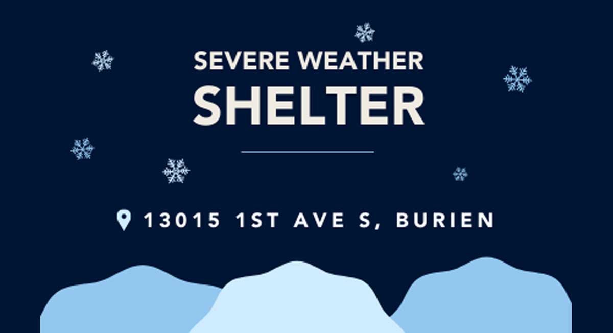
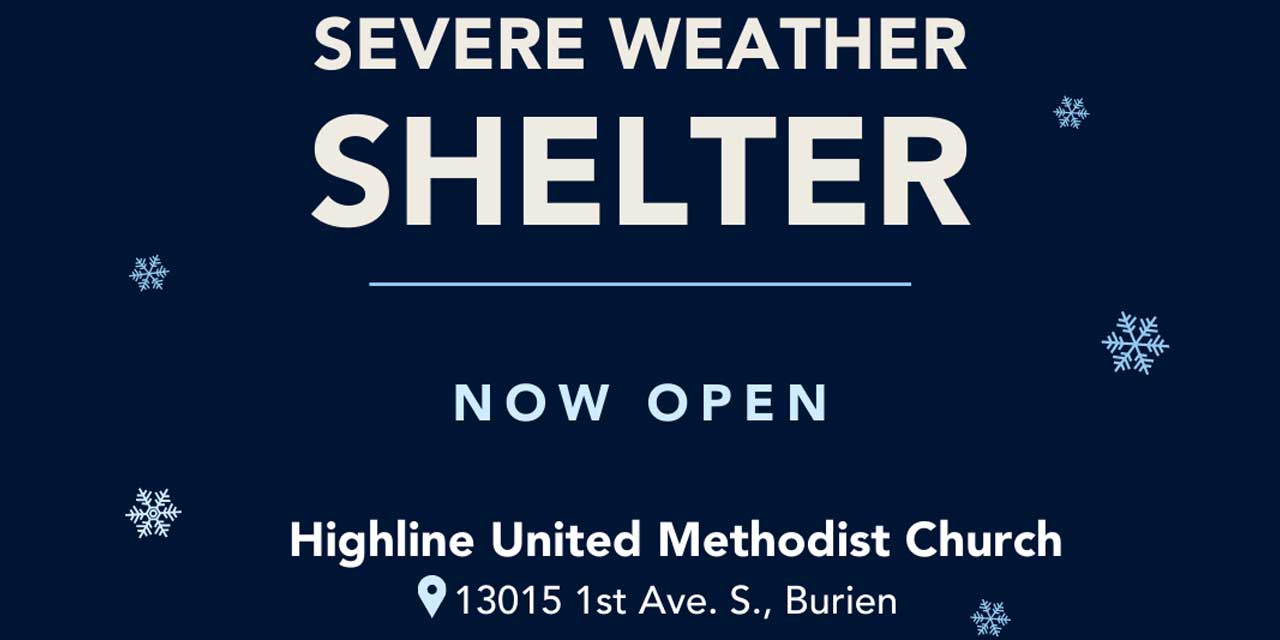
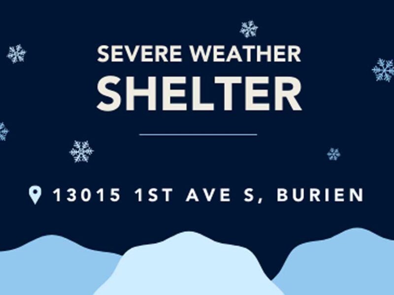
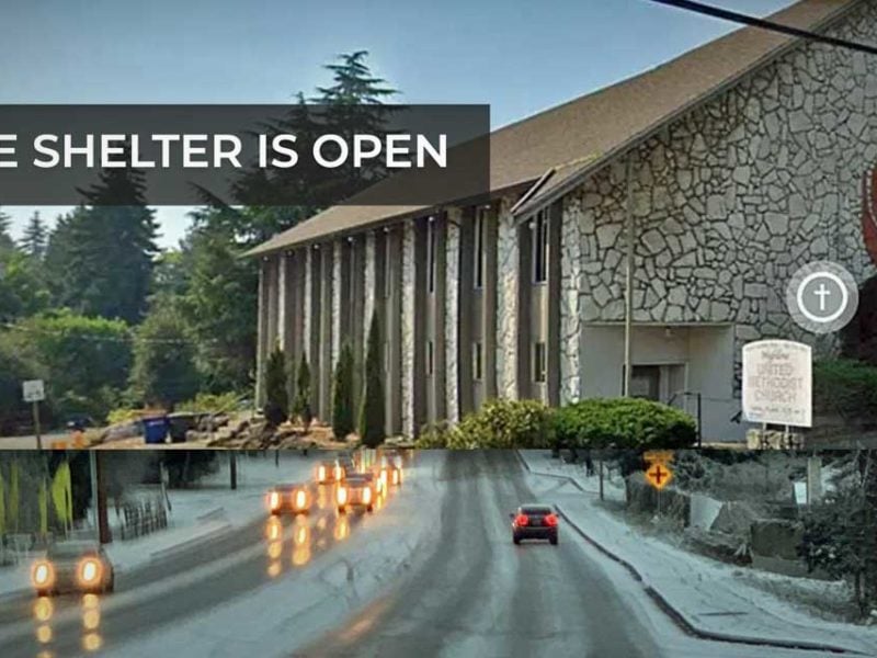
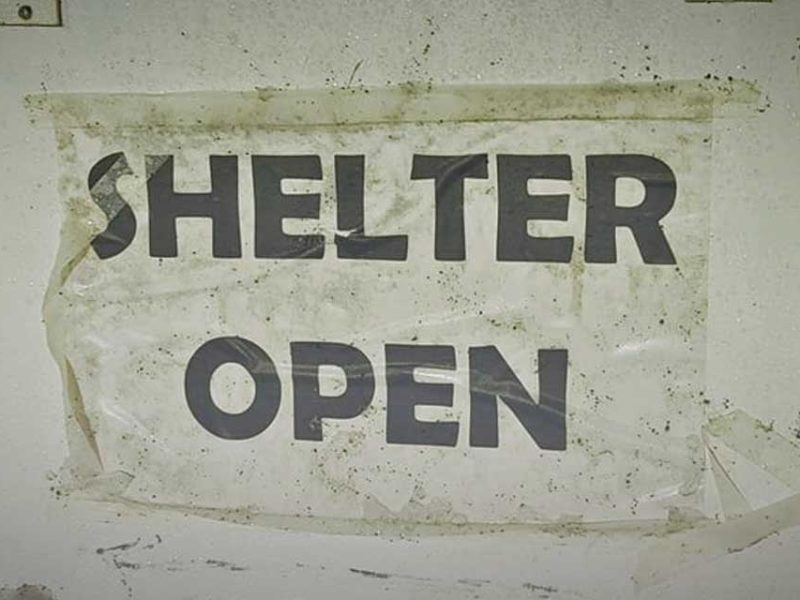
Monday, Dec. 21st will be the “shortest day of the year” as the annual Winter Solstice happens at precisely 9:47am PST, marking the beginning of Winter for us Earthly Northern Hemispherians.
At 9:47am, the Sun will be directly over the Tropic of Capricorn, which is about 23.5 degrees south of the equator. As the earth rotates around the Sun on its tilted axis, the Northern Hemisphere “leans away” from sunlight, making for “shorter days” and colder temperatures.
Winter Solstice is often referred to as “the shortest day of the year,” but that’s wrong – it still contains 24 hours, ya silly goose. It just has the least amount of sunlight. So stop calling it the “shortest,” will ya? You’re giving the Earth a “short day complex.” Next thing ya know, it’ll be driving a big truck.
Some fun Winter Solstice facts:
- While most Winter Solstices occur on Dec. 21st, there have been years when the solstices have occurred on Dec. 20th and/or Dec. 23rd, but this is fairly rare. The last Dec. 23rd solstice occurred in 1903 and will not occur again until the year 2303. A Dec. 20 solstice has occurred very rarely, with the next one occurring in the year 2080. So mark your Outlook Calendars now.
- Winter solstice’s varying dates are mainly due to the calendar system with 365 days in a year with 366 in a leap year.
- Solstice is a Latin word which means “sun stands still,” referring to the appearance that the Sun’s noontime elevation change stops its progress, either northerly or southerly.
- Solstices occur twice a year – Dec. 21st and June 21st, because our planet is tilted by an average of 23.5 degrees as it orbits the sun – the same phenomenon that drives the seasons.
So…Happy Winter Solstice to one and all! And remember, the days will all be getting longer from now until June 21st!
The National Weather Service has released an updated forecast for this weekend, and they’re saying we may, just possibly have a 30-40% chance of SNOW starting Friday night (Dec. 11th) continuing through Sunday.
Of course, weather prognosticators are never wrong, are they? We sure hope not.
Here’s their latest day-by-day predictions, as of 9pm Wednesday Dec. 9th, most certain to change as the clock ticks:
- Thursday Night: Mostly cloudy, with a low around 26. East northeast wind around 6 mph becoming calm.
- Friday: Mostly cloudy, with a high near 38. Calm wind.
- Friday Night: A 30 percent chance of snow. Cloudy, with a low around 28. Calm wind becoming north northeast around 6 mph.
- Saturday: A 40 percent chance of snow. Snow level 300 feet. Cloudy, with a high near 40.
- Saturday Night: A chance of snow. Snow level 300 feet. Cloudy, with a low around 32. Chance of precipitation is 50%.
- Sunday: A chance of rain and snow showers. Cloudy, with a high near 41.
- Sunday Night: A chance of rain and snow showers. Cloudy, with a low around 36.
- Monday: A chance of rain and snow. Cloudy, with a high near 42.
- Monday Night: A chance of rain. Cloudy, with a low around 42.
Cliff Mass adds:
A lot of you are wondering about snow. I have been wondering too. The problem is that the models are not consistent for this weekend and early next week. This morning our local model forced by the GFS..the NWS’s best large scale forecast model, indicated a major snowstorm late Monday. But I don’t trust any of it at this point and you shouldn’t either. Thursday and Friday until dinnertime looks dry for western Washington…and cold. You can bank on that.
BTW, a record low of 18 was set at SeaTac Airport Wednesday morning (Dec. 9th). The previous low was 21, set in 1972.
| Dec ’09 |
| 12 |
| 11:00 am |
Normandy Park’s first-ever Winter Festival will be held this Saturday, Dec. 12th, from 11am to 4pm at the Normandy park Towne Center (located at 200th & 1st Ave South).
From their poster (download/view PDF here):
Join us at the first Normandy Park Winter Festival in Towne Square (1st Avenue at 200th) for holiday fun.
A free family event with over a dozen kids’ activities including Santa photos (bring your pets, too!), face painting, cookie decorating, Rockie the Police Dog, karaoke and caroling, and performances by Melanie’s Dancers.
Give back. Bring an item for the “Stuff the Trailer” senior gift drive or a food bank donation, and receive a free cocoa, cider or coffee at the Little League Trailer.
Support your local Normandy Park businesses. Raffles every half hour. Win prizes and gift certificates, receive discount coupons, and shop for hand-made gifts from local artists.
Raffle Sponsors:
- Archery Bistro
- Optimal Health Chiropractic
- SkySoles Reflexology
- Benson’s Best Bites
- Richard Steppic Wood Turning
- Emerald City Smoothie
- Companion Animal Medical Center
- Starbucks
Special thanks for generous sponsorship by:
- Normandy Park Senior Living
- Highline Little League
- Melanie’s Dance Unlimited
Here’s a video promo:

Two advisories were released Friday (Dec. 4th) – by the National Weather Service and King County, warning of “Arctic air” moving in as well as the possibility of “slick driving conditions” this weekend as temps drop down into the low 30s and upper 20s.
Sadly for most school-aged children, no snow is in the forecast (sorry kids…).
First, the National Weather Service’s “Special Weather Statement” released at 4:46pm 12/4:
… Cold weather to continue into next week for western Washington…
A secondary and stronger surge of cold air will filter into western Washington late this weekend. Temperatures will continue to run well below normal into late next week as Arctic high pressure slides south in western Canada allowing modified Arctic air into the area. High temperatures will remain in the 30s through most of next week with low temperatures well below freezing.
Snow showers are possible Saturday night as an upper low passes over the region. No accumulations are expected… except perhaps light accumulations for the northern shores of the Olympic peninsula where an upslope component and moisture picked up over the northern interior waters may produce accumulating snows late Saturday night and Sunday morning. Windy conditions will develop Saturday evening through the first half of Sunday for the northern interior and Strait of Juan de Fuca as Fraser outflow increases.
And here’s King County’s warning on road conditions (link to the county’s road condition map here):
King County Road Alert Spotlight
The King County Road Services Division is alerting motorists of the possibility of slick driving conditions as temperatures cool and roads remain wet.
A brief rain shower that moved through parts of the county this afternoon may leave just enough moisture on some roadways to cause slick driving conditions tonight.
While many roads in unincorporated King County have been treated with anti-icing materials, motorists should still be on the lookout for icy stretches of roadway, especially in higher elevation areas and on bridges and overpasses.
If you are traveling tonight or early tomorrow morning, use extra caution and be prepared for winter driving.
And one more weather-related blurb to share, this one from noted Meteorologist Cliff Mass’ Blog on Thursday, Dec. 3rd
You have delicate plants…protect them. When the winds die down on Monday morning the temperatures could plummet on the western side into the teens in some locations. Maybe even colder Tuesday am. Good weather for plumbers–could have some frozen and bursting pipes.
And watch the action offshore! As the cold air moves over the relatively warm water there will developing cumulus activity…including showers. There will be lines of convection…should be impressive.
Monday and Tuesday will be cold and sunny. That’s far enough to forecast…but remember…sometimes the most interesting weather happens when a cold spell ends. I won’t even mention that unspeakable four letter word: S**W. Don’t even think about it.
The National Weather Service issued a “Wind Advisory” early Wednesday morning, so again, be sure to double-tie down your blue (and other colored) tarps Burien, as sustained winds of 20-30mph may be coming.
Here’s the advisory in all its weatherspeak glory:
… Wind Advisory in effect from 1 PM this afternoon to 1 am PST Thursday…
The National Weather Service in Seattle has issued a Wind Advisory… which is in effect from 1 PM this afternoon to 1 am PST Thursday.
Southerly winds will increase today… peaking late this afternoon through the evening hours. Sustained winds of 20 to 30 mph are expected with gusts to 40 to 50 mph… mainly this evening. The strongest winds are expected to occur over the north Hood Canal across to western Snohomish County… the entrances to the Strait and over the lower Chehalis valley.
Precautionary/preparedness actions…
A Wind Advisory is issued when sustained winds of 30 to 39 mph or gusts of 45 to 57 mph are likely. Winds this strong can snap small tree branches… topple small or shallow-rooted trees… and cause local power outages.
The National Weather Service issued a “Special Weather Statement” at 4:30pm Thursday (Nov. 12th), warning of a “vigorous cold front” hitting the area Friday morning, bringing rain, wind and snow to the mountains.
Could this be the first breath of ol’ man winter?
Here’s the statement:
… Active weather day expected Friday…
A vigorous cold front will pass southeast across western Washington Friday morning… bringing Rain… Mountain snows… locally windy conditions and possibly snow showers to parts of The Lowlands.
South winds in advance of the front will increase late tonight into early Friday morning… mainly along the coast and parts of the northwest interior including the Admiralty Inlet region. Wind speeds in those areas are expected to reach 20 to 30 mph with a few gusts to 45 mph… mainly in and around the Island County area. After the front passes… winds will become west to southwest down the Strait of Juan de Fuca and across the northwest interior before diminishing through the afternoon. While below Wind Advisory criteria… wind of this strength could blow down a few tree limbs here and there with isolated power outages.
Colder air will surge in behind the front and lower already low snow levels across the region. During the morning hours ahead of the front the snow level will be around 1500 to 2000 feet. The snow level will then gradually drop through the day to around 500 feet by evening. This means some of the highest hills around the region could see a few snow showers late Friday into Friday evening. However… outside of the mountains or the immediate Cascade foothills… little to no snow accumulation is expected.
Dry and tranquil weather will return to the region late Friday night into Saturday.

Snow squalls slammed the Burien area this afternoon, chock full of hail-like snow “pellets” which turned to regular flakes which have either lightened up or stopped entirely.
The question on everyone’s mind of course is:
Will the snow continue tonight?
Will school be delayed or closed tomorrow?
The National Weather Service says there’s a 90% chance of snow this afternoon, with lows hitting the mid-20s tonight, but only one to three inches accumulation:
AN ARCTIC FRONT IS PUSHING SOUTH THROUGH THE PUGET SOUND REGION BRINGING INTENSE SHOWERY WEATHER TO THE REGION. THE FRONT EXTENDS FROM THE KITSAP PENINSULA EAST AND ARCS NORTHWARD BACK INTO SNOHOMISH COUNTY WHERE IT HAS DROPPED A COUPLE OF INCHES ON THE EVERETT AREA. SOUTHWESTERLY FLOW AHEAD OF THE FRONT IS SPARKING INTENSE SHOWERS FOR THE SOUTHERN SOUND TOWARD THE CASCADES FOOTHILLS. HAIL…SNOW AND THE OCCASIONAL RUMBLE OF THUNDER MAY BE PRODUCED BY THESE SHOWERS ACROSS THE SOUTHERN SOUND. THE FRONT WILL PUSH THROUGH THE SEATTLE METRO AREA AROUND 2 PM DROPPING A DUSTING TO 2 INCHES OF SNOW IN THE HEAVIER SHOWERS. THE FRONT WILL PUSH TO THE SOUTHERN SOUND IN THE AFTERNOON…POTENTIALLY AFFECTING THE EVENING COMMUTE.
Tuesday should be warmer, and we don’t know yet about any school closures or delays; best bet is to check www.schoolreport.org first thing in the am.
This Afternoon: Snow showers. High near 39. North northwest wind around 11 mph. Chance of precipitation is 90%. Total daytime snow accumulation of 1 to 3 inches possible.
Tonight: Scattered snow showers before 11pm. Partly cloudy, with a low around 26. North northwest wind between 9 and 14 mph. Chance of precipitation is 40%. New snow accumulation of less than a half inch possible.
Tuesday: Mostly sunny, with a high near 41. Northeast wind around 6 mph.
Here’s a closeup of the “snow pellets” that pelted B-Town around 1:30pm Monday:


Yes, it’s snowing lightly in Burien with temps in the low 30s, but as of 7am Monday morning there are no reported school delays or closures.
Here’s the latest forecast from the National Weather Service – up to an inch of snow is possible:
Today: Snow showers likely. Mostly cloudy, with a high near 40. Calm wind becoming north northwest between 7 and 10 mph. Chance of precipitation is 60%. Total daytime snow accumulation of less than one inch possible.
Tonight: A 40 percent chance of snow showers before 11pm. Mostly cloudy, with a low around 26. North northwest wind between 9 and 13 mph. New snow accumulation of less than a half inch possible.
We’re certainly having a lively winter, and even though Spring is scheduled to start in just two weeks (March 20th), there’s a chance of snow in the forecast for Saturday night!
Here’s the statement from the National Weather Service:
Statement as of 5:36 AM PST on March 06, 2009
… Snow showers possible across The Lowlands this weekend…
A strong cold front will pass through western Washington on Saturday bringing cool and unstable conditions to the region. Onshore flow will increase behind the cold front with showers expected Saturday afternoon into Sunday. Snow levels will remain quite low…near sea level with rain possibly mixing with snow in heavier showers. Snowfall accumulations will be spotty with up to 1 inch of snow possible from stronger showers. Locally heavier amount may be found across the higher hills of King and Snohomish counties as a Puget Sound convergence zone develops Saturday afternoon through early Sunday. Heavy snow is also expected across the western slopes of the north and central Cascades.
Cool and showery weather will persist into early next week with temperatures remaining below normal. Low temperatures will be in the mid 20s to lower 30s with afternoon highs in the upper 30s to lower 40s.
Be sure to check in with The B-Town Blog if anything exciting happens, and/or email us your snow photos!
As of 6:02am Thursday Feb. 26th it’s snowing in the Burien area, and here are the latest weather-related updates:
- HIGHLINE SCHOOL DISTRICT: 2 HOURS LATE
Updated: 5:42 a.m. February 26, 2009
Highline Public Schools will operate two hours late today. Emergency bus transportation is in effect.
*There will be no breakfast, no morning classes for preschool, kindergarten, ECEAP, or PSSC. Afternoon classes for these programs will be on time.
*Schools will dismiss at regular times.
Snow and power failures can cause disruptions for schools and families. During these difficult times, HIghline Public Schools will do all it can to communicate vital information to parents and students.
Our top priority is student safety!
- SEATTLE PUBLIC SCHOOLS: 2 HOURS LATE:
2 Hours Late.
Buses Operate on Snow Routes.
No Door-to-Door Service.
No A.M. or P.M. Head Start.
No A.M. or P.M. Kindergarten.
Here’s the latest from the National Weather Service:
Statement as of 4:35 AM PST on February 26, 2009
… Additional snowfall of an inch or two and freezing temperatures will warrant caution this morning…
Hazardous driving conditions will be the rule across western Washington this morning due to snow that has already fallen… possible accumulations of another inch or two… and freezing temperatures.
Scattered snow showers will continue this morning as the upper level low pressure system over the area moves eastward. Local
additional accumulations of an inch or two are possible. In addition temperatures have fallen below freezing across most of western Washington this morning… so roads and sidewalks will be icy even if they are free of snow.These conditions will be relatively short lived. Temperatures will climb above freezing by noon today with highs around 40… and most of the area will have partly sunny skies.
If you’re going to be out driving, here are live webcam views – to get the latest view, be sure to refresh the page:


)


)
)
)

The National Weather Service issued the following Advisory Wed. morning about potential snow showers coming tonight/Thursday:
Statement as of 4:21 AM PST on February 25, 2009
… Local snow showers are expected over the western Washington lowlands late tonight and Thursday…
A cooler air mass will move into western Washington tonight… and it will be cold enough for showers to fall locally as snow or rain and snow mixed across the western Washington lowlands late tonight and Thursday.
Widespread snow accumulations are not expected… and high temperatures Thursday will reach the lower to mid 40s. However spotty accumulations of 1 or 2 inches are possible mainly in the northwest interior… along Hood Canal… and in the southwest interior late tonight or Thursday morning.
So be prepared…ol’ man winter might be making one final appearance!
More info/links:

Somewhat surprising that it’s actually snowing in Burien now, and the National Weather Service has issued this Advisory:
… Winter Weather Advisory remains in effect until 6 PM PST this evening…
Along the I-5 corridor of King… Pierce… Thurston and Lewis counties…1 to 3 inches of snow accumulation is expected.
Heaviest snowfall will occur over the Kitsap peninsula west of Puget Sound… where 2 to 4 inches of accumulation is expected in the Bremerton area.
Precautionary/preparedness actions…
A Winter Weather Advisory means that periods of snow… sleet… or freezing rain will cause travel difficulties. Be prepared for slippery roads and limited visibilities… and use caution while driving.
For our area, they’re calling for:
- Snow accumulation between 1 and 4 inches, contiuing tonight, with temps in the upper 30s.
- Snow decreasing overnight. Snow accumulation up to one inch. Lows in the upper 20s to lower 30s. Southeast wind 10 to 15 mph.
- Mostly cloudy. A chance of morning showers. Highs in the lower to mid 40s. North wind near 10 mph.
No word yet on school closures for Wednesday, but stay tuned for updates – we’ll post ‘em as we get ‘em (that is, as long as our Server holds out and the site stays online…).
| Jan ’09 |
| 31 |
| 8:00 am |
Burien Parks is sponsoring a special family snowshoe outing this Saturday, Jan. 31st at Snoqualmie Summit, leaving Burien at 8am.
Here are the details:
WHAT: Family Snowshoe Outing
WHEN: Saturday, Jan. 31st, leaving B-Town at 8am
WHERE: Snoqualmie Summit
WHO: Adults must be accompanied by a child 7 years or older.
COST: $20 per person
INFO: As of 1/25/09 there were still 11 spots available, so act fast! “Come spend some quality time together doing an activity the whole family can enjoy! Snowshoeing is one of the fastest growing, easiest to learn, and healthiest winter activities. Leave the driving to us!”
REGISTER: Call (206) 988-3700 to register or for more info: CLICK-N-GO

Underneath these dinghys and picnic table lies a physical, wooden dock that is usually above the waterline of Lake Burien, but Thursday is partially submerged due to the record rainfalls. Photo by Cynthia Reid.
According to the National Weather Service, a record amount of rainfall fell at Sea-Tac Airport on Wednesday, Jan. 7th – 2.29 inches!
This kicks the butt of the lame old record, which was a paltry 1.33 inches, set in 1996.
We’re going into a slight dry spell now, with just an 80% chance of rain Thursday, with more clearing on Friday.
However, the massive amounts of moisture that fell are now either overflowing rivers and streams, or overflowing the soil, and the danger for landslides is still high; here’s a list of signs to look for if you live in a known slide area (courtesy the USGS website)
- Springs, seeps, or saturated ground in areas that have not typically been wet before.
- New cracks or unusual bulges in the ground, street pavements or sidewalks.
- Soil moving away from foundations.
- Ancillary structures such as decks and patios tilting and/or moving relative to the main house.
- Tilting or cracking of concrete floors and foundations.
- Broken water lines and other underground utilities.
- Leaning telephone poles, trees, retaining walls or fences.
- Offset fence lines.
- Sunken or down-dropped road beds.
- Rapid increase in creek water levels, possibly accompanied by increased turbidity (soil content).
- Sudden decrease in creek water levels though rain is still falling or just recently stopped.
- Sticking doors and windows, and visible open spaces indicating jambs and frames out of plumb.
- A faint rumbling sound that increases in volume is noticeable as the landslide nears.
- Unusual sounds, such as trees cracking or boulders knocking together, might indicate moving debris.
Also, the Cedar River in Renton was above its “flood stage” at 15.8 feet Thursday morning; flood stage is 12.0 feet. A Flood Warning remains in effect for it until Saturday evening, and its expected that the Cedar will crest around 16.4 feet at Noon Friday, flooding areas of Renton, including the airport.

Long story short: if you live in a valley, near a river or flood zone, or on a bluff above or near a slide zone, you’re SCREWED, as a major storm is moving in and the National Weather Service has issued THREE advisories:
- Flood Watch (previously posted here)
- Major Wind Advisory
- “Special Weather Statement” on increased landslide danger
Here’s the Wind Advisory:
… Wind Advisory in effect until 10 am PST Wednesday…
The National Weather Service in Seattle has issued a Wind Advisory… which is in effect until 10 am PST Wednesday.
A strong storm which is bringing heavy rain to the mountains is also causing strong winds in the Seattle area. These winds will last off and on through the night and diminish Wednesday morning.
Precautionary/preparedness actions…
A Wind Advisory is issued when sustained winds of 30 to 39 mph or gusts of 45 to 57 mph are likely. Winds this strong can snap small tree branches… topple small or shallow-rooted trees… and cause local power outages.
And now, the “Special Weather Statement” regarding heavy rains and the potential for landslides:
… Heavy rain to dramatically increase risk for rainfall induced landslides…
Previous rainfall amounts have been around two to three inches in the Seattle area over the past 18 days. This has resulted in moderate levels of soil moisture around western Washington. Heavy rainfall of nearly two inches in 24 hours and over three inches in 48 hours is expected this afternoon through Wednesday night. This amount of rain will put extra pressure on soil instability leading to an increased risk of landslides in slide prone areas. A diminishing risk of landslides will continue for several days after the rain ends.
The slow melt of the snow that has fallen over the last couple of weeks has had an additional soil wetting effect. In areas outside of Seattle… storm total rainfall could be 3 to 8 inches in The Lowlands and 10 to 20 inches in the mountains. For these reasons the landslide risk is higher than the USGS charts would suggest.
The amount of rainfall forecast in 24 hours… on top of the cumulative rainfall over the last three weeks… will push western Washington soils to the point where they are above the USGS landslide index. When cumulative rainfall exceeds the USGS landslide cumulative threshold index… rainfall induced landslides are possible during intense rainfall or when rainfall amounts exceed two inches in 24 hours.
While the USGS rainfall thresholds were designed for the Seattle area of the Puget Sound… most of The Lowlands of western Washington are similarly susceptible to landslides caused by wet soils. Areas most susceptible to landslides under these conditions are steep coastal Bluffs and other steep hillsides.
For more information about current conditions… visit www.Weather.Gov/Seattle… select hydrology… and then scroll down for the link to the USGS landslide information Page.
If you need help, here’s some info that may come in handy:
- Sandbags are available for anyone in flood area – check this website here for details
- King County’s Flood Warning Center is operating; a recorded flood-information hotline is also updated each hour for citizens wanting information in flood areas:
- Call 206-296-8200 or 1-800-945-9263
- Citizens who need help interpreting flood information should call 206-296-4535 or 1-800-768-7932
- Call 206-296-8200 or 1-800-945-9263
- Problems on county-maintained roads can be reported by calling 206-296-8100 or 1-800-KC-ROADS

Numerous Burien-area residents were in the dark Sunday night, and it wasn’t just because the sun went down – Seattle City Light reports that power was lost last night around 8pm to nearly 3,900 homes.
According to Mike Eagan of Seattle City Light, there were two outages overnight, both caused by falling tree branches laden with heavy snow:
1. Boundaries – 1/4/2009 8:03:00 PM:
- North – S Barton St;
- South – SW 152nd St;
- West – Puget Sound;
- East – 10th Ave S;
- Approximate customers affected: 3899
- Cause: UNKNOWN It was a Tree
- Estimated power restoration time for the above outage: January 5, 2009 at 6 a.m. 100% power restored at 1:28am 1/5/09
2. Boundaries – 1/4/09 early am (time unknown):
- North – S. 96th
- South – SW 175th
- West – 24th SW
- East- 33rd SW
- Cause: Tree
- 95% power restored as of 9:25am 1/5/09
6:15am UPDATE 1/5/09: :Last night’s snow is melting (or has melted depending on where you are), and it looks like all Highline Schools are operating on a normal schedule, with NO delays.
- However, JFK High School will be starting LATE – at 10:30am.
- Most King County Metro Transit buses are on their regular routing for Monday morning, but some will be chained. This could cause some service delays as the buses travel more slowly across both slushy and bare roadways. Metro riders to check service status online or by calling (206) 553-3000 before traveling today.
- Today’s weather forecast shows NO SNOW: “Scattered showers. Mostly cloudy, with a high near 47. West southwest wind between 10 and 15 mph. Chance of precipitation is 50%.”

UPDATE 10:30pm 1/4/09: Looks like the sudden rush of heavy snow showers is fading and/or turning to a wet mix, so perhaps both garbage collections and school will go on as normal on Monday.
Outside The BTB Home HQ (near sea level) we received just over an inch of the stuff, which was very heavy and wet – not a good mix for branches and power lines; in fact, we heard of some sporadic power outages around Burien, including the Seahurst neighborhood around 9:30pm.
Be sure to check here Monday morning for the latest weather, school and road closure updates, and in the meantime, enjoy another exciting winter’s night!
PREVIOUSLY:
UPDATE 7pm 1/4/09: Okay, so perhaps we’ll be wrong about tonight’s snow, but according to the precipitation prognosticators, the snow is supposed to turn into rain late tonight/early tomorrow.
However, that hasn’t stopped the National Weather Service from posting this Winter Weather Advisory, which is in effect until 9pm tonight:
… Winter Weather Advisory in effect until 9 PM PST this evening…
The National Weather Service in Seattle has issued a Winter Weather Advisory… which is in effect until 9 PM PST this evening.
Snowfall amounts of 1 to 3 inches are likely across the Seattle… Tacoma and Everett areas… with snow changing over to rain later this evening.
Precautionary/preparedness actions…
A Winter Weather Advisory means that periods of snow will cause travel difficulties. Be prepared for slippery roads and limited visibilities… and use caution while driving.
PREVIOUSLY: It’s snowing again in Burien, but don’t worry folks – even though tomorrow is the first day back at school for kids, our patented B-Town Blog Weather Rock™ predicts that temps will be in the upper 40s tomorrow will change everything to rain as well as prevent any rash decisions by school officials.
However, one never knows with the weather ’round these parts, so be sure to check back and watch the webcams we’ve got posted here, and be sure to refresh the page to see the latest images:
)

)

If the recent snowstorms got your blood pumping and adrenaline flowing, and the reason wasn’t because of the plethora of terrible B-Town drivers, then we’ve got something for you – you can now take a touring-style bus each Wednesday during January and February to go skiing at Crystal Mountain with the Burien Backslider Ski Club!

Pam Harper, Mt. Rainier and Alex Brown are regular Backsliders. Okay, so maybe Mt. Rainier isn't, but you get the picture.
Here’s a history of the Backsliders, courtesy Burien resident Guy Harper:
The Burien Backslider Ski Club, originally organized by Edna Graham, started as the Burien Ski Bus. Edna met with the Highline Recreational Council in 1959 and explained that many other districts sponsored a ski bus; however there was none from the Highline area. The council thought it was a good idea and gave their approval to Edna to make all the arrangements. She, in conjunction with retailers “Osborn and Ulland,” who had a sports store in Burien at the time, managed to start the original Burien Backslider group and made Snoqualmie Summit their initial destination of choice.
Lou Whittaker was one of the first ski instructors of this young and colorful group of women. It was not unusual on the way home from the ski area to stop at North Bend to take on a case of beer or two as wine was just not the “in” thing to do at that time. The roster for one of these early trips included many of the current old-timers still living in Burien.
Later, when Crystal Mountain was scheduled to open in the early 1960’s, many of these skiers wanted to change the ski destination from Snoqualmie to Crystal. To settle the dilemma, a meeting was held at the Normandy Park Cove. The meeting was organized by Edna Graham with support from Ada Mottet and Imogene Briacks. A vote showed there were enough skiers who favored Crystal Mountain and that the extra bus expense could be justified – and so Crystal became the new ski destination.
Someone at that Cove meeting said, “What will we call ourselves?” Arlene Brown quickly spoke up and said, “What about the Backsliders?” Everyone laughed but that name stuck immediately and continues today.
Adrian Kelly, far left, of Mick Kelly's Irish Pub, adds a touch of Irish to each trip. And perhaps a pint of Guinness afterwards.
Lucy Osbun, one of the early members, said that for the first ten years or so, the club was just for women and that eventually they had enough women to fill two buses with other folks on the waiting list. At one time, it actually took three buses to carry this women’s-only group to the ski slopes. It was a very lively bunch with many becoming very interested in hiking and camping around the Pacific Northwest.
In the beginning there were no elected officers. The operation was run by the organizers and the prime movers of the club. Sometime later, the idea of elected officers took hold but even then there were no paid season lift passes for the officers. The job, however, demanded some sort of remuneration and free passes became the accepted routine that continues to this day.
The first staging area in Burien where the skiers could meet the bus was the parking lot at the old A&P store near Five Corners. Then it was moved to Moshier Field, and after that the Burien Elks parking lot; currently the Fred Meyer store location on First Avenue South serves as the pickup spot.
There were bridge players on the early buses who wanted to combine bridge with the bus ride home. Venida Osols, who was an officer at that time, always made a special effort to obtain a bus with a convertible seat that could be turned into a card table. This arrangement played host to many stirring and sometime hilarious games.
Inez Burkhard was known at the “Champagne Lady,” as it happened to be her birthday during the ski season each year. She would bring a case of Champagne on board the bus each year to celebrate the occasion. That must have been quite a ride home! Pre-season ski club lunches were organized in 1975 and continue to this day.
In those early days, the road to Crystal was unimproved which resulted in cars without chains becoming stuck in the dips and the entire ski population would come to a halt for a time. Guard rails that were next to vertical drop-offs were marginal to say the least. The drive to and from Crystal was sometimes very tense due to the glare ice and no available sand for the highways back then. Those were exciting times! No wonder beer and wine became so popular on the way back down to the flat lands. To this day, many of the bus riders also bring “finger food” to pass around the bus and nibble on the way down and at times, a Backslider bus will break into songs of earlier years.
This coming year promises to be a good one at Crystal. The roads are safe and wonderful. There are new lifts and improvements almost every year. Willie Grindstaff continues to be one of the outstanding ski instructors at Crystal and the BBS are privileged to have his services. It’s a great time to meet new friends and enjoy the wonders of the Pacific Northwest.
If you’re jonsein’ for some real snow fun, you should check out the Burien Backslider Ski Club; for more information, call or email Yvonne Shimek at 425-745-2335 ymshimek@hotmail.com.
Just when you thought that 2008 couldn’t get any worse as far as winter weather goes comes this new Advisory about another “strong storm” that could blow away your New Year’s Eve hangover this Thursday and Friday:
… Another strong storm could potentially bring windy weather to parts of western Washington Thursday through Friday…
A strong storm system is expected to arrive in two parts Thursday and Thursday night bringing a threat of heavy Rain… Mountain snow… and possibly high winds to parts of western Washington. National Weather Service computer models continue to indicate a high degree of uncertainty regarding the strength and track of the incoming weather system. Latest models have trended toward a weaker surface low tracking into the far south or central Washington coast… and due eastward across the south or central sound. At this time it appears a southern track is more likely… putting the area at greatest risk of high winds over Oregon and extreme southern Washington. The rest of Washington would experience breezy to locally windy conditions at times… especially across the Washington coast south of Aberdeen. If the system tracks slightly further north… high winds could be experienced south of a line from near Kalaloch along the central Washington coast to Tacoma. South winds in this less likely scenario could reach 30 mph with gusts to 45 mph.
Snow will be heavy at times in parts of the Cascades Thursday through Friday resulting in difficult travel conditions and a high avalanche danger. Refer to the latest winter storm and avalanche statements for details.
River flooding across the far southern lower elevation basins is also possible. It appears the skokomish and Chehalis river are at greatest risk of flooding. There could also be areas of urban and small stream flooding affecting the Metro corridor… especially from Everett southward… where the highest rainfall amounts are expected. Refer the latest flood statements for details in the event watches or warnings are issued.
This is a rapidly evolving and complex storm system. A lot of uncertainty still exists so current forecasts should be monitored closely. For more information listen to NOAA Weather Radio or visit www.Weather.Gov/Seattle for the latest statements regarding this storm. People planning travel across the Cascade passes should be prepared for hazardous driving conditions at times through Friday.
Personally, we think this new “Wind Advisory” should’ve been issued Monday around 11:30am (when gusts hit 43mph at Sea-Tac Airport) but we’ll take what we can get, right?
And what we’ll get is wind. Lots of wind. Which means…potential power outages, so be prepared folks.
And now, here’s the latest Weather/Wind Advisory from the National Weather Service:
… Wind Advisory in effect for the interior lowlands from 6 PM this evening to 7 am PST Wednesday…
The National Weather Service in Seattle has issued a Wind Advisory… which is in effect from 6 PM this evening to 7 am PST Wednesday.
A strong Pacific frontal system will move onto the Washington coast around midnight tonight and inland by early Wednesday morning. The strongest winds across most inland areas will occur ahead of the front… with southerly 25 to 35 mph with gusts to 50 mph possible. Expect the strongest winds over the east Strait to occur with the front after midnight… where southwesterly winds of 25 to 35 mph with gusts to 50 mph are possible.
Precautionary/preparedness actions…
A Wind Advisory is issued when sustained winds of 30 to 39 mph or gusts of 45 to 57 mph are likely. Winds this strong can snap small tree branches… topple small or shallow-rooted trees… and cause local power outages.

King County announced today that they’re offering assistance for property and business owners who suffered damages due to our recent winter weather.
Here’s the announcement in its entirety:
Property and business owners who had losses due to the recent winter weather may be eligible for assistance getting their property back in order. Eligibility is determined through a damage assessment process which takes into account total reported losses within King County.
Impacts of winter weather, such as snow load and flooding, may have resulted in individual property damages or business losses. King County homeowners and small business owners who have suffered damages from recent weather related conditions should file a damage report with King County Office of Emergency Management within the next two weeks.
A hotline number (800-523-5044) has been established for reporting damages within King County and is open during the following dates and times:
Dec. 29 – Dec. 31, 2008
8:30 a.m. – 4:00 p.m.Jan. 5 – Jan. 9, 2008
8:30 a.m. – 4:00 p.m.Before filing a damage report with OEM, citizens should contact their insurance company about existing coverage. They are also urged to document damages with photographs and keep records of all clean-up and repair costs.
In addition, business owners who have incurred weather-related economic losses should submit an Economic Injury Disaster Loan Program form to the Office of Emergency Management (fax# 206-205-4056). The form can be downloaded from the Washington Emergency Management Division’s website (http://emd.wa.gov/disaster/documents/EconomicInjuryWorksheetnew9-2007.pdf).
For more information, contact the Office of Emergency Management or visit the office website (http://www.kingcounty.gov/safety/prepare.aspx).

Starting around 11:30am Monday morning (Dec. 29th), we’ve noticed numerous major wind gusts blowing all sorts of loose garbage and recycling all around Burien.
We don’t remember reading any Weather Advisories on this, so we just checked the NOAA Weather website for live conditions at Sea-Tac Airport, and here’s what we found:
WIND GUSTS UP TO 43 MPH!
Here’s a screenshot from the website:

And here’s a live feed from a webcam at the airport – if there’s no image, or if the airplanes in the image are on their sides, that means the wind gusts are even worse (refresh the page to see the latest image):
The good news from this sudden windstorm?
Kiteboarding’s up at 3 Tree Point!
Please either email us your windstorm pics or add ‘em to our Flickr Group so we can share them!
If I do say so myself…ahem, I am an unusually calm and cool driver.
Even in the calm and cool snowstorm we just survived.
Unforeseen curbs, sidewalks and even an errant jaywalker rarely cause me any distress.
However, this last week, I cannot contain myself any longer – Burien drivers (and you know who you are!) are summarily grounded when the snow falls!
RANT: DO NOT drive in the snow unless you know what the ‘H-E-Double-Toothpick’ you are doing!
Snow accumulation of one-inch or more constitutes a universal ”inept snow driver stay at home” grounding. This rule must be enforced by all police officers on patrol. I don’t care if you are having a much-needed coffee break in U.U. office at Starbucks, get out there and control the mayhem! Underwood-Undercover is willing to make a Citizen’s Arrest whenever her services are needed. No need for the errant driver to know that she officially deputized herself, like some arrogant female Barney Fife (a great role model if ever there was one).
RANT: A slick tire is a type of tire that has no tread pattern; these tires are used on RACECARS, not your Volvo! DO NOT attempt to drive in the sleet and slush with worthless wheels on your ancient Volvo, dude.
RANT: Under no circumstances can a weak driver with the dribbles back down (more like slide sideways) a giant hill to try again and “get a run at it.” Other competent, strong forces are trying to get up the hill.
RANT: Plan ahead you boofus, especially if Grandpa Joe is driving in geezer gear ahead of you. Use the horn man, and slip-slide your way around him. Oncoming traffic can be flashed off with multiple blinks of headlights. Again – it’s every (snow)man for himself.
RANT: Pedestrians – get the ‘H-E-Double-Toothpicks’ off the main road. Put on your freakin’ snow boots and walk (trudge) on the non-existent sidewalk. I know it’s hard going but it’s better than being run over by “Mr. Volvo Slick Tire.”
RANT: Do not stop in the middle of the already very narrow plowed main road to “help” a motorist stuck in the snow bank in the center of the road. For Gawd’s sake man, how are the other drivers supposed to: first of all stop, and second of all, get around you? Being an upstanding citizen does not negate using common sense!
Underwood-Undercover cannot think of any actual Raves with regards to driving in the snow; but sledding in the snow = plenty of raves.
RAVE: To U.U.’s daughter, who found an awesome steep driveway with plenty of trees to dodge (more exciting) and zero sledders competing for the steepest path. Way to go!
RANT: The very steep hill of Tuffie’s 1 and 2 (an aforementioned columnist’s favorite neighborhood dogs) is awesome for sledding, but dude! Where is the lookout on the bottom of the hill? U.U. has twice narrowly missed snow-blind boarders sliding right onto Maplewild.
As I look at my column now, I see that I have only one Rave.
Sad but true, but remember a Driver (especially a lame-o snow driver) is a “club with a wooden head.”
Twenty-five years of living in Burien gives Humorist Shawn Underwood much fodder for her writings.
All of her stories are true, or at least have a grain of truth with no added embellishments.
Or something like that.
Read more of her humor at her website here.
Monday (Dec. 29th) will be the first garbage and recycling pickup day for a lot of Burien residents in two weeks, so get your containers out there, and remember – triple volume accepted!
Here’s the latest from Waste Management:
Residential service for Monday garbage customers and those scheduled for recycling and/or yard waste service today. If this is not a regular recycling or yard waste collection week, customers will need to wait for service until the week of Jan 5-9.
Double/triple volume accepted; Tips for Managing Extra Garbage & Recycling.
Please remove snow from on top of and around containers. If your street is still snowy, please move your containers to a more accessible location for service.
CONTACT INFO:
Email: info@wmnorthwest.com
Phone: 1-800-592-9995
Fax: 1-866-284-1337City of Burien Garbage and Recycling Help Line: 206-933-0992
We’ve got ours out, neatly arranged in triplicate and ready to go…have you?

There will be NO garbage/recycling collection in Burien Saturday or Sunday (12/27-28), with up to triple amounts of stuff accepted during the next pickup.
Here’s the latest update from Waste Management (more info available at their website here):
Saturday, December 27, 8:00 AM: Unsafe road conditions have unfortunately required Waste Management to once again postpone residential curbside collection in Snohomish County and most of King County, including Burien, Renton, and all East King County areas.
No residential collection will be provided on Sunday, as previously reported. Waste Management needs to preserve driver time for long work hours next week as we clean up the accumulated material resulting from numerous collection delays.
King County residents outside the City of Seattle may take garbage and recycling to King County transfer stations, including:
- Bow Lake in Tukwila
- Enumclaw
- Renton
- Factoria
- Houghton
- Shoreline
Call 206-296-4466 or visit http://your.kingcounty.gov/solidwaste/facilities/transfer.asp for addresses and hours.
Remove Snow Accumulation. To keep containers accessible, please remove snow and extra material from around or on top of them.
Clear Storm Drains to Prevent Street Flooding: As snow melts, water run-off can result in flooding, which further impedes collection. Please clear storm drains of snow and debris to prevent flooding.
Tips for Extra Material Storage and Set Out: Waste Management suggests that residents use the following options for storing and setting out extra materials:
Extra garbage: Place next to garbage container in:
- Securely tied plastic bags labeled “Garbage” or
- 32-gal can with handle and lid (65 lb limit) labeled “Garbage”
Extra recycling: Place next to recycling cart in:
- Plastic recycling bins or
- Cardboard boxes (2×2x2 ft. limit) labeled “Recycling”
- No recycling in plastic bags
Extra yard trimmings (No food scraps or plastic): Place next to yard cart in:
- Heavy paper yard bags (available at hardware stores) or
- Reusable polywoven yard bags (available at hardware stores) or
- 32-gal cans with handles & lids (65 lb limit) labeled “Yard” or
Bundles tied with sisal twine (4′x2′ limit)

Only patches of snow remain in the Burien area Saturday (some side roads may still be slushy), and proof that it is melting lies above in the sad crime scene photo of a one-time Snowman’s remains found on an area lawn.
But fear not B-Towners, for we all know that Frosty will return again.
The only question remains: how soon?
What we do know is:
- The rain will continue for the next several days with highs in the 40s.
- A Flood Watch is still in effect for small streams in King County; here’s the warning from the National Weather Service:
Rain locally heavy at times will persist through tonight. Rainfall amounts of a half to one inch with locally higher amounts on the coast are likely by Sunday morning. This combined with melting snow across The Lowlands or elevations below 2000 feet will likely result in some urban or small stream flooding. Residents in urban areas are strongly encouraged to clear any blockages of storms drains before it causes flooding problems.
Excessive runoff from rain and snow melt will cause ponding of water on highways… streets and underpasses… in urban areas with poor or overwhelmed drainage… and will also cause elevated levels on small creeks and streams.
Do not underestimate the power of flood waters. Only a few inches of rapidly flowing water can quickly carry away your vehicle.
Sure, there aren’t any major rivers running through the Burien area, but we do have some significant creeks (ie: Miller & Walker Creeks), so everyone should make sure to clear any storm drains near your home, and if you’re near any of the above-mentioned creeks, please check on them and make sure they’re flowing well.
Here’s the official Flood Watch warning:
… Flood Watch remains in effect through Sunday morning…
* a Pacific storm will bring warmer air and raise the snow level significantly. The combination of increasing southerly winds… milder temperatures… and rain on snow will result in rapid snow melt across The Lowlands tonight and Saturday. There is also the potential for minor flooding of the Skokomish River Saturday as the snow level climbs to near 5000 feet on the olympic range.
* The combination of rain and melting snow across The Lowlands could result in urban and small stream flooding… especially in those areas where a foot or more of snow was still on the ground. Snow and ice may result in clogging of storm drains that could result in flooding of streets and… possibly…homes and businesses.
* The Chehalis river and its tributaries could also approach or exceed flood stage. Up to two feet of snow covers the Chehalis watershed and it will all likely melt by Sunday. That water… along with the rain… will cause the rivers of southwest Washington to rise significantly.
Precautionary/preparedness actions…
A Flood Watch means conditions are favorable for flooding but flooding is not imminent or occurring. Monitor the latest forecasts from the National Weather Service and be ready to act quickly if flooding is observed or a warning is issued.
And remember – if you have any interesting weather-related photos to share, please either email us or add ‘em to our Flickr Group so we can share them!

Courtesy BTB Contributing Photographer Gregory Rehmke comes this nighttime photo of Lake Burien, which appears to have thawed out, as well as grown some seasonal sparkling lights and an airport tower in the upper right corner…
Have any cool photos to share?
Please either email us or add ‘em to our Flickr Group so we can share them!
Garbage/Recycling provider Waste Management says that there will be NO pickups Friday, Dec. 26th in the Burien area, although they will allow “up to triple volume accepted next regular collection day for each missed curbside container.”
Here are some snippets from their latest update:
Holiday Collection Schedule Friday and Saturday weeks of Dec 25 & Jan 1:
Friday, December 26:
(although there will be no pickup today…), Waste Management’s Customer Service Center will be open from 8 AM – 5 PM:
- Waste Management Customer Service website
- Call 1-800 592-9995
Because of weather delays, we expect phone lines to be extremely busy, resulting in long waits. The alternatives below will help customers get information quickly:
- Double Triple volume will be accepted on the next regular collection day for each missed residential container. If a container is missed twice, triple volume will apply.
- If you have too much material to fit in your containers, check our Tips for Managing Extra Garbage and Recycling.
You can e-mail Customer Service regarding specific concerns by locating your city or county contact address on the menu provided.

Carolyn Rosenfield found an easier way to get around Burien – by cross country skiing on SW 172nd in 3 Tree Point. Photo by John Naubert.
10:45am 12/24/08 UPDATE: The soggy rain transition period continues, and with it comes potential new dangers like clogged storm drains, slushy roads, large walls of plowed, heavy snow and excessive roof loads.
Some updates:
- The City of Burien’s offices will be open until 2pm this afternoon.
- All Burien Parks and Recreation programs are canceled for the week.
- Far as we know, most restaurants in Burien are open today (including The Mark)
- Normandy Park residents have until 3:30pm to haul their own garbage/recycling to one of two locations for disposal (think of yourself as Santa; read this post here for details)
- Metro Transit is focusing on core service until weather and road conditions improve, which means bus service will be significantly limited during the weather emergency. Information about bus status is available on Metro’s Ice & Snow page, which is updated frequently. You can also call the Metro Customer Information Office at (206) 553-3000, but call volumes are high and there may be a wait to talk to a CIO representative.
- Burien’s garbage & recycling service has been canceled for today, Dec. 24 (Waste Management) http://www.wmnorthwest.com/weatherboard.html
- Residents are advised to avoid piling snow on top of storm drains when shoveling sidewalks and driveways. Storm drains need to be kept clear, so when the snow melts the runoff has some place to go. Residents are encouraged to clear snow from storm drains, when streets are clear of cars, after snow and ice starts to thaw. Clearing snow from storm drains will help to reduce the amount of localized flooding, which is likely to occur based on weather forecasts of warming temperatures and rain.
Here’s some info from the City of Burien’s website on excessive roof loads:
Recent weather conditions in the region resulting in abnormally heavy snowfalls may result in excessive roof loads on buildings due to the accumulation of snow and ice.
The series of snow storms that have hit the state have left several inches of snow and ice on roofs, which have added to the total weight that trusses and rafters must support. A cubic foot of snow can weigh from seven pounds for snow that is new and dry up to 30 pounds for old, compacted snow. Rain falling on accumulated snow will add even more weight. The combination of these factors and the recent forecast which calls for more snow and rain over the next couple of days may cause an excess of snow loading on many roofs.
Watch for Early Warning Signs of Overloading:
- Be on the watch for these warning signs:
- Severe roof leaks, indicating torn roof membranes.
- Ripples or bends in metal supports.
- Loud popping noises emanating from the building structure.
- Water ponds in areas where it never accumulated before.
- Obvious deformities in the roof.
What to do if you Suspect Overloading
When snow removal is necessary, it should be remembered that unsafe procedures may cause a collapse and injuries. Anyone working on a roof must have adequate fall protection and keep in mind that workers and others nearby can be injured by snow being dumped from a roof.Once it has been determined that the snow must be removed, there are several options for snow removal.
Most roofing contractors are equipped to handle snow removal from the roof of your home and buildings.
Another option is to remove the snow yourself. The best way to do this is to get up on your roof and push the snow off with a broom or shovel. It is important to use ladders, safety ropes and take necessary precautions.
Snow rakes also can be used to remove snow. When using a snow rake, use extreme caution when working near overhead electrical power lines. Also, avoid excessive scraping on the roof or trying to chip off any ice.
And finally, here’s a cool website where kids of all ages can watch Santa’s progress as he delivers his goodies around the world:
Normandy Park residents who are fed up with having to store their own garbage and/or recycling can actually dispose of their stuff today (Wed. 12/24) between 9am and 3:30pm, if they can get out that is.
Here’s an update from Allied Waste/Republic Services:
Allied Waste/Republic Services Emergency Service Alternative for Normandy Park
In recognition that the extended inclement weather has created storage issues for garbage and recycle commodities, the Bellevue Division is offering a temporary solution:
Today Normandy Park has agreed to provide access to two community sites where residents who wish to utilize this opportunity to dispose of their recyclables and garbage may do so. These sites are cleared of snow and will allow Allied Waste /Republic Services to spot attended vehicles so residents can dispose of household recyclables and garbage.
- This service will be available from 9 AM till 3:30 PM, Tuesday Wed., December 24, 2008
- One vehicle will collect garbage only and another will collect recycle only
- Waste Service employees will monitor for contamination and customer compliance
Site 1 is the loop drive and parking lot area in front of City Hall, just off of SW 174th where we placed the container after the windstorm two years ago.
Site 2 is the parking lot at Marvista Park next to the Public Works shop at 19900 4th Avenue SW.
Lake Burien is still partially frozen Wednesday morning, with a fresh dusting of scenic snow. Photo by Gregory Rehmke.
Looks like we’re in the icky weather transition period where the snow turns into rain (depending on where you live – we’re near the water and it’s raining here), and the roads become a huge slushy mess – a perfect day to clear any and all storm drains near your house, as the next phase will involve lots of water.
There’s still a Winter Weather Advisory in effect until 4pm today:
The Winter Weather Advisory is now in effect until 4 PM PST this afternoon.
Snow is expected to continue this morning. By late morning or early afternoon the snow will change over to rain in locations below 500 to 1000 feet. The higher hills continue with snow through this afternoon.
Up to two inches of new snow is possible before the change over to rain. Higher amounts are possible on hills above 500 to 1000 feet.
Snow showers could bring additional accumulations late tonight and on Christmas day.
Precautionary/preparedness actions…
A Winter Weather Advisory for snow means that periods of snow will cause primarily travel difficulties. Be prepared for snow covered roads and limited visibilities… and use caution while driving.
More BTB Reader photos to share – first, Jessica Gran’s pics of a homemade igloo; she says:
“The kids had enough snow to make an igloo, with two brick walls protecting the entry way.
The ultimate fortress for a snowball fight!”


Then, from Virginia in the Hurstwood neighborhood comes this photo of one of her lit-up lawn reindeers doing its best “ostrich impression” with its head in the snow:

Have any cool snow/ice photos to share?
Please either email us or add ‘em to our Flickr Group so we can share them!

3:30pm 12/23/08 UPDATE: As of 3pm, the National Weather Service released this Winter Storm Advisory – 2 to 4 inches of snow are expected Wed. Dec. 24th, with a transition to rain also:
… Winter Weather Advisory in effect from midnight tonight to 4 am PST Thursday…
The National Weather Service in Seattle has issued a Winter Weather Advisory for snow… which is in effect from midnight tonight to 4 am PST Thursday. This upgrades the Winter Storm Watch which had been in effect.
Snow is expected to begin after midnight tonight and continue through Wednesday morning. The snow will be light at first but then increase its intensity on Wednesday morning. Late on Wednesday morning or early in the afternoon… locations below 500 to 1000 feet will transition to a cold rain… while higher hills continue with snow through Wednesday afternoon.
Snowfall totals of 2 to 4 inches are expected. Significantly higher amounts are possible on hills above 500 to 1000 feet or anywhere that precipitation might continue as snow through the afternoon and evening.
Snow showers could bring additional accumulations on Christmas day.
Precautionary/preparedness actions…
A Winter Weather Advisory for snow means that periods of snow will cause primarily travel difficulties. Be prepared for snow covered roads and limited visibilities… and use caution while driving.
Also, this update about garbage collection in Normandy Park:
Garbage Collection
Allied Waste has not been able to collect residential garbage and recycling due to road conditions. City staff and Allied Waste have arranged for residential drop off services at two locations in Normandy Park.Residential customers will have access to collection vehicles/containers for residential garbage and recyclables on Wednesday, December 24th from 9:00 a.m. to 3:30 p.m. at the locations below:
City Hall Parking Lot – 801 S.W. 174th Street
and
Marvista Park Parking Lot – 19900 4th Avenue S.W.
Regular collection services will resume when road conditions improve and collection vehicles are able to safely operate on residential streets.
11:15am 12/23/08 UPDATE: Looks like another snow storm is coming tonight (Tues. 12/23), with up to six more inches of snow predicted to fall overnight.
Perhaps we will indeed have a “White Christmas” after all?
AREA UPDATES:
- City Hall and the Parks office will be open today until 2pm.
- Burien Parks and Recreation programs are cancelled for today.
- No garbage/recycling pickup today (more details here).
- Road crews continue to plow and sand streets starting with main arterials and moving to secondary streets when they are able. More details about priority routes can be found on our Snow & Ice Routes Map [PDF]. Please drive with extreme caution and only if necessary.
WEATHER UPDATE:
Here’s the latest Winter Storm Watch from the National Weather Service:
… Winter Storm Watch in effect from late tonight through Wednesday evening…
The National Weather Service in Seattle has issued a Winter Storm Watch… which is in effect from late tonight through Wednesday evening.
Another low pressure system is expected to drop southeast into the Pacific northwest late tonight into Wednesday. A relatively cold air mass will be in place ahead of this system. With the cold air in place… up to another six inches of new snow is possible by Wednesday evening with the snow beginning sometime late tonight. As the system moves through… the low level wind flow will become southwesterly. This should warm up the air mass enough to change the precipitation from snow to rain. This transition is expected to occur Wednesday afternoon but there is plenty of uncertainty surrounding the timing of this transition if it even occurs at all.
Precautionary/preparedness actions…
A Winter Storm Watch means conditions are favorable for severe winter weather. If you must travel in the watch area… carry an extra flashlight… food… water… and blankets in case of emergency.
Live webcam view from Sea-Tac Airport.
Refresh page to get latest image.
Also, according to the Port of Seattle, Sea-Tac Airport’s stranded travelers are starting to clear out, which must be a relief for everyone who got stuck there.
A local tech Writer named John Cook got stranded at Sea-Tac for seven hours, and here’s a snippet from his blog:
Seven hours.
That’s how long my fellow passengers and I spent waiting on the airport tarmac Sunday as an uncharacteristic winter blast brought SeaTac airport to a grinding halt.
Here’s a link to his interesting first-hand account.
And here’s an update from the Port on the current airport conditions:
The airport is open and the runways are clear for operations. The situation is improving, but there are still flight cancellations and delays. Please check with your airline before starting for the airport. You can also check your flight status online (http://hosting.portseattle.org/fids/FlightInfo.aspx) on the Port’s Web site or via text messaging.
If your scheduled flight is canceled, rebook travel over the Internet or over the phone; do not come to the airport. Long lines at the ticket counters make it more efficient and quicker to rebook off-site.
If a scheduled flight is planned to depart, allow extra travel time to the airport to accommodate challenging regional road conditions and lines at ticket counters and security checkpoints. Plan to arrive at the airport two hours before departure time. It’s a good idea to bring necessary items (diapers, snacks, etc.) in case there are delays and/or long wait times. Airport concessions are open, stocked and prepared to serve.
The airport is continuing to provide volunteer staff in the terminal to assist passengers, answer questions, and assist with line control / crowd control issues.
Here are some more great BTB Reader snow photos culled from our Flickr Pool:
“Looked like steam was rising out of the water.” Photo by B-TownMom.
“Checking out how the B-Town Blog car held up under the snow.”
Photo by B-TownMom.

And here’s a slideshow of snow on Lake Burien from BTB Reader Gregory Rehmke:
Have any cool snow/ice photos to share?
Please either email us or add ‘em to our Flickr Group so we can share them!

Just got some info from Jenn Ramirez-Robson of the City of Burien, who forwards us this update from Waste Management on Burien-area garbage and recycling pickup (missed again today but scheduled for another try next week, when you can put out TRIPLE the amount of garbage and recycling as usual):
Monday, December 22 – Due to inclement weather, Waste Management has cancelled collection services for their customers in King, Snohomish, Kitsap and Skagit Counties.
Please note that our call center will not be open until it’s safe for our employees to return to the office.
For the most up to date status of your service we urge you to go to our website: www.wmnorthwest.com/weatherboard.html.
Residential customers: Twice the regular amount of garbage, recycling and/or yard waste will be accepted at no additional charge on the next regularly scheduled collection day for each container. If your next regularly scheduled collection falls on a holiday, Waste Management will collect the following day. For example, due to Christmas, this week’s Thursday customers will be serviced on Friday and Friday customers will be serviced on Saturday.
Residential customers in the City of Seattle: If inclement weather causes missed collections for one day, missed customers will be picked up the following day and all other residential collection will be pushed back one day. If two consecutive collection days are cancelled due to inclement weather, customers may set out a double load on their next scheduled collection day.
Commercial customers. Priority service is given to locations such as hospitals and restaurants where public health is a high priority. All other commercial customers will be serviced as soon as conditions allow for safe collection.
Waste Management is committed to providing reliable collection for all customers. However, in the event that circumstances such as unsafe roads interfere with service schedules, we appreciate customer understanding and cooperation as we manage collection on emergency scheduling.
Waste Management customers are strongly encourages to visit our website for up-to-the-minute collection updates www.wmnorthwest.com/weatherboard.html.
If garbage is missed twice, residents may put out three times as much on the third scheduled collection day. We certainly will do all we can to keep that eventuality to a minimum!
We are also using outdial phone calls to help keep residents as well informed as possible.
Reminders about how to package extras:
If recycling or yard waste is regularly collected every other week, the missed material will be collected on the next scheduled day for that container (two weeks from the missed collection), unless residents are otherwise notified by telephone or on this site.
Extra garbage: Place next to garbage container in:
- Securely tied plastic bags labeled “Garbage” or
- 32-gal can with handle and lid (65 lb limit) labeled “Garbage”
Extra recycling: Place next to recycling cart in:
- Plastic recycling bins or
- Cardboard boxes (2×2x2 ft. limit) labeled “Recycling”
- No recycling in plastic bags
Extra yard trimmings (No food scraps or plastic): Place next to yard cart in:
- Heavy paper yard bags (available at hardware stores) or
- Reusable polywoven yard bags (available at hardware stores) or
- 32-gal cans with handles & lids (65 lb limit) labeled “Yard” or
- Bundles tied with sisal twine (4′x2′ limit)
Live webcam view from Sea-Tac Airport.
Refresh page to get latest image.
Sea-Tac Airport is apparently jammed full of people stuck as the result of numerous flight cancellations and delays.
Apparently Alaska and Horizon Airlines resumed limited service Monday after thousands of stranded travelers spent the night at the airport, where hundreds of flights have been canceled since Friday.
If you’ve got travel plans and want to get the latest information, we recommend a two-pronged approach using both your telephone and internet:
- Call your airline via the number listed below (or on your itinerary/ticket).
- At the same time, try accessing the Port of Seattle’s travel info website or your specific airline’s website.
So basically, you’ll have a phone in your ear while you surf the web, and eventually you’ll either get through or you’ll get your update. Just don’t give up.
Here’s the latest update from the Port of Seattle (access their airport travel info website here):
The airlines continue to face a number of challenges during this weather event.
Many flights been canceled. Please check your flight before coming to Sea-Tac Airport.
See contact information below:
- Aeromexico 800 237-6639
- Air Canada (including Air Canada regional airlines) 800 247-2262
- Air France 800 237-2747
- AirTran Airways 800-247-8726
- Alaska Airlines 800 426-0333
- American Airlines 800 433-7300
- Asiana Airlines 800 227-4262
- British Airways 800 247-9297
- Continental Airlines 800 525-0280
- Delta Air Lines 800 221-1212
- EVA Air 800 695-1188
- Frontier Airlines 800 432-1359
- Hainan Airlines 888 688-8813
- Hawaiian Airlines 800 367-5320
- Horizon Air 800 547-9308
- JetBlue Airways 1-800-JETBLUE
- Korean Air 800-438-5000, (206) 241-1576
- Lufthansa Airlines 800 399-LUFT
- Midwest Airlines 800 452-2022
- Northwest Airlines 800 225-2525
- Scandinavian Airlines 800 221-2350
- Southwest Airlines 800 435-9792
- Sun Country Airlines 800 359-6786
- United Airlines (including United Express) 800 241-6522
- US Airways 800 428-4322
- Virgin America 877 359-8474
Some great night-time photos courtesy of BTB Readers Brooke & Andrea Trisler, taken in Burien Sunday Dec. 21, 2008:
Welcome to Bedford Falls – er, we mean Olde Burien.
You practically expect to see Jimmy Stewart running
down the street yelling at everyone…
There’s just something about snow, neon and
holiday lights at night that warm your heart…
Have any cool snow/ice photos to share?
Please either email us or add ‘em to our Flickr Group so we can share them!

5:30pm 12/21 UPDATE: Snow’s still falling, and by our estimations a grand total of 7-1/2 inches are on the ground now near our home office. That means that an additional 2-1/2 to 3 inches fell since yesterday afternoon, including a hard layer of ice that’s now under about 1-2 inches of snow.
And get this – some are predicting an additional 5-8 inches overnight!
Also, due to this event, Alaska Airlines has canceled all Alaska and Horizon airlines flights into and out of both Seattle and Portland. More info at the Port of Seattle’s airport website here.
Here are some selected weather warning snippets, as well as the latest Winter Storm Warning:
TONIGHT: Snow this evening will give way to lingering snow showers late. Low 28F. Winds E at 5 to 10 mph. Chance of snow 70%. Snow accumulating 2 to 4 inches.
MONDAY: Intermittent snow showers, especially early. Temps nearly steady in the low to mid 30s. Winds NNE at 5 to 10 mph. Chance of snow 40%. Snow accumulations less than one inch.
… Winter Storm Warning in effect until 4 am PST Monday…
The National Weather Service in Seattle has issued a Winter Storm Warning… which is in effect until 4 am PST Monday. The Winter Weather Advisory is no longer in effect.
An additional 3 to 6 inches of snow is expected through tonight in the Puget Sound lowlands and the lower Chehalis valley. A few isolated locations could receive as much as 8 inches. Snowfall amounts will be variable from location to location.
Precautionary/preparedness actions…
A Winter Storm Warning for heavy snow means significant snowfall is occurring or imminent. Snowfall intensities will be heavy enough to reduce visibilities to near zero at times.
Here’s an earlier update from the City of Burien:
No major power outages overnight in Burien
City staff continue to monitor weather conditions. Please check back for weather related closures and information. The weather forecast still calls for more snow, ice and cold temperatures. Go to www.weather.gov/seattle for updated forecasts and weather warnings.Road crews have plowed and sanded most of the main arterials and are working on the secondaries. More details about priority routes can be found on our Snow & Ice Routes Map [PDF].
Metro Bus Service:
Once again due to the weather and dangerous driving conditions, King County Metro Transit will be operating approximately half of its normal bus service for Sunday, Dec. 21 and will run three Seahawks shuttles.Information about bus status is available on Metro’s Ice & Snow page, which is updated frequently. You can also call the Metro Customer Information Office at (206) 553-3000, but call volumes are high and there may be a wait to talk to a CIO representative. Please drive with extreme caution and only if necessary.
PREVIOUSLY:
Just when you thought Ol’ Man Winter was done introducing his bad self to Brrrien comes this news from the National Weather Service – 2-4 more inches of snow are due to hit the area today:
The Winter Weather Advisory is now in effect until 4 am PST Monday.
After a brief break in precipitation through midday…moderate to occasionally heavy snow showers will move across western Washington with an incoming frontal system. New snowfall accumulations of 2 to 4 inches are likely in the interior lowlands between this afternoon and midnight tonight while heavier 6 to 9 inch accumulations are likely in the mountains. In the mountains east winds gusting to 30 mph will produce some drifting and blowing of the snow.
Snow shower activity will taper off from the north around midnight tonight.
A Winter Weather Advisory means that periods of snow or freezing rain will cause travel difficulties. Be prepared for slippery roads and use caution while driving.


