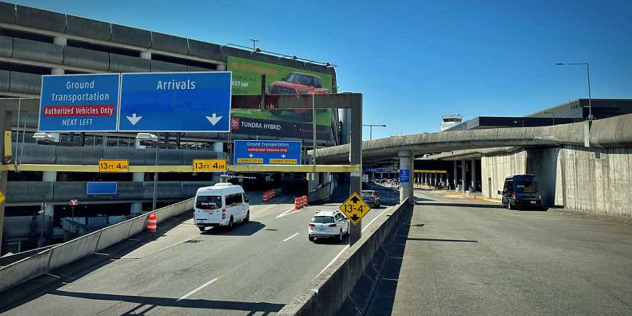
As we were returning (slowly of course) on Sylvester Road from an all-day excursion to the eastside, we were nearly run off the road by an approaching large truck-like vehicle in the opposite lane.

Turns out it was a snowplow.

An actual snowplow.

Plowing the snow.

In Brrrien!

As you may recall from a report we did on Thursday (Dec. 18th), several Burien-area residents were upset enough with the previous lack of city snowplowing and road care that they posted numerous rants on Craigslist.

Speaking of Mr. Plow, the City of Seattle sends us this press release about their road-clearing efforts, which we’ve truncated here:

At a briefing this evening at the Emergency Operations Center, Mayor Greg Nickels announced that a fleet of 27 snow plows are clearing Seattle roads and seven utility repair crews stand ready to respond as a winter storm hits the region.

The city of Seattle activated its Emergency Operations Center at 2 pm on Saturday, coordinating responses by the Department of Transportation, Seattle City Light, Seattle Public Utilities, Human Services, Police, Fire and Parks departments.

Snow and ice removal crews will continue clearing arterial roads through the night. Road conditions may become icy tonight as temperatures drop. Two trucks will be dedicated to the West Seattle Bridge and the Alaskan Way Viaduct. The Seattle Department of Transportation is urging residents only to drive if necessary.

A primary concern tonight is expected to be high winds, particular in east King County. At this hour, there are no power outages within the city of Seattle, but City Light is prepared to call in as many crews as needed if conditions change.

Three severe weather shelters remain open at least through Monday night: City Hall, Frye Hotel, and Seattle Center Pavilion B. Shelter beds are still available. Last night, 143 people stayed at the three shelters. During the day, Seattle residents can find warm, public space at Parks Department community centers and the Seattle Center. The following community centers will be open on Sunday from noon to 5 p.m.: Garfield Community Center, Rainier Beach Community Center, South Park Community Center, Rainier Community Center and Hiawatha Community Center.

Seattle’s recycling and garbage transfer stations will be closed tomorrow. Solid waste customers who were missed for pickup today should bring in their containers until next week.

Not to be outdone, the City of Burien issued its own safety alert this afternoon:

SEVERE WEATHER ALERT: Snow & high winds are predicted for today, and Burien residents are urged to be prepared for possible power outages and extreme cold.

The City of Burien is monitoring conditions and will post updated information as it becomes available to the City website (www.burienwa.gov).

All Parks & Recreation programs and facility rentals are canceled. Metro Bus Service is severely impacted.

For complete and up-to-date information regarding this severe storm, visit the National Weather Service website at www.weather.gov/seattle.

Of course we went to the city’s website, expecting to see more detailed info, but alas, the most recent update was from yesterday (Fri. 12/19). Hmmm…

Also, here’s the latest Winter Storm Warning from our friends at the National Weather Service:

A Winter Storm Warning remains in effect until 10 am PST Sunday.

Another round of heavy snow is expected tonight through Sunday morning. Heaviest snow will occur on the Kitsap peninsula… along Hood Canal… and from Olympia and Chehalis west to the central coast near Ocean Shores. 10 to 18 inches of snow is expected close to the Hood Canal. Other locations within this area should get 5 to 12 inches of snow.

Along the I-5 Corridor North of Tacoma… including Seattle and Everett… storm total snowfall of 4 to 8 inches is expected. In general… lighter amounts will occur near the Cascade foothills with heavier amounts farther west along the shores of Puget Sound. Some parts of eastern King County… where wind is a big threat… will receive 1 inch or less of snowfall.

Late tonight into Sunday morning… freezing rain is possible in Grays Harbor County and the lower Chehalis valley. If more precipitation occurs in the form of freezing rain than snow…  then an ice storm would be possible with ice accumulations in excess of one quarter of an inch. Ice storms are capable of causing power lines and large tree branches to snap and cause major travel disruptions.

Precautionary/preparedness actions…

A Winter Storm Warning means significant amounts of snow… sleet… and ice are expected or occurring. Strong winds are also possible. This will make travel very hazardous or impossible.

And the B-Town Blog Weather Rock™’s first-hand (or rock) report is thus:

  • As of 7pm 12/20, 1-inch of new snow has accumulated since the storm moved in this afternoon. We now have between 5-7 inches of snow here, and growing.
  • The new snow is icier, powdery, and harder to make snowballs and snowpeople with. Dang.
  • This type of icy snow sparkles in the basking glow of the still-functioning street lights. Purdy.
  • The Weather Rock™ predicts 3-5 inches will fall overnight.
  • The Weather Rock™ has detected little or no wind. Yet.
  • Our new kerosene heater is still sitting in its box, awaiting emergency use for potential power outages.
  • Some sleet is mixed in with this batch of precipitation – evidenced as it clumped up quickly into freezing messes on the windshield as we drove. Is this a sign of a potential “ice storm” that may be developing? Stay tuned…

“Frozen Downspout” by Scott Schaefer, taken at 11:45am 12/19/08, 3 Tree Point.

12/19/08 1:30pm UPDATE: The Snow Day continues, with the temp still hovering around 29 degrees, and here’s the latest:

  • All schools are still closed. None have re-opened.
  • Buses still operating at low capacity. Walk instead. Check Metro’s “Ice & Snow Status” website (or call 206-553-3000) Metro says they will be providing bus service only on cleared highways and arterial roads, and to major transit centers and park-and-ride lots, with little service on side streets and in smaller neighborhoods. Also check Sound Transit’s website.
  • The City of Burien is still closed.
  • Most roads are still extremely dangerous, but many main ones have been sanded (including Maplewild SW outside our house).
  • Many business are actually open.
  • Many weekend events are still going on – check the Event Calendar on the right sidebar for the latest.
  • Weatherfolk are still predicting another, much-worse storm hitting the area Saturday night/Sunday morning!

AREA ROAD CLOSURES/HAZARDS:
From the city’s website:

Burien road conditions are deteriorating. Please drive with only if necessary and with extreme caution

Road crews concentrate on getting and keeping primary routes (like 1st Ave S) plowed. Once the snow stops and the primary routes are clear, crews move to the secondary routes and then neighborhood roads. Following the plows are the sanders to provide traction on the ice. Snow plows’ rubber blades do not remove ice.More details about priority routes can be found on our Snow & Ice Routes Map [PDF].

OTHER ROAD CLOSURES:

  1. CLOSED: The entrance to SR509 at 5th Ave South @ 11248 North in Boulevard Park due to ICE HAZARD

OTHER CLOSURES:
BURIEN CITY HALL IS CLOSED TODAY
Due to current road conditions and safety concerns Burien City Hall and the Burien Community Center are closed today. More severe weather is expected over the weekend, including high winds. Please prepare for possible power outages as well as continued cold temperatures.

All Burien Parks and Recreation Programs & Rental are canceled for Friday, December 19th. Call (206)988-3700 for updated information.

GARBAGE RECYCLING COLLECTION:
Far as we can tell, no garbage/recycling will be collected until next week; from Waste Management’s website:

Due to severe road conditions, we have stopped collection of ALL residential routes in the City of Burien. As such, very few homes were actually collected. We will collect “double the amount” on their next regularly scheduled colleciton day.

ONLINE RESOURCES:

LATEST WINTER WEATHER ADVISORY (as of 7:58 AM PST) – BIG SNOW/WIND STORM DUE SAT. NIGHT:

… Winter Storm Watch in effect from Saturday evening through late Sunday night…

The National Weather Service in Seattle has issued a Winter Storm Watch for most of the western Washington lowlands and the Olympics… which is in effect from Saturday evening through late Sunday night.

This developing winter storm will be different from the storm that brought snow to western Washington Wednesday and Thursday. As always happens with snow storms over western Washington… the winds interacting with terrain will determine where the heaviest snow accumulations will occur… as well as which areas will receive very little snow accumulation.

Strong east winds will predominate Saturday through Sunday. This means that the heaviest snow accumulations will most likely be over the Kitsap peninsula and along Hood Canal… where the east winds will enhance the snowfall by creating upslope conditions as they encounter the Olympics. Snow accumulations here could range from 6 inches to a foot and a half.

Another location where east winds may enhance the snow is along the western Strait of Juan de Fuca and the north coast where 6 to 15 inches is possible.

The track of the frontal system across southwest Washington and Oregon means greater snow fall will occur over the southwest part of western Washington. Snow accumulations of 4 to 10 inches may be possible over the southwest interior and the central coast. In addition… local sleet and freezing rain is possible as warm air aloft from the system moves overhead. Parts of the immediate coast may change to rain Sunday morning.

There will be a rapid drop off in snow accumulation as you move east and north of central Puget Sound. The strong east winds affecting The Lowlands east of Puget Sound will limit snow accumulations so that anywhere between a trace of snow and two inches is possible. The Seattle-Tacoma Metro area is in the transition zone between the Kitsap peninsula and areas east of Puget Sound… so snow accumulations are especially uncertain.

Total accumulations here through Sunday afternoon could range from a trace to 4 inches.

This storm will be weakest over the northwest interior… and early on in the storm… snow will be light. However snow may pick up later Sunday as the upper level low trailing the main front begins affecting the area. The San Juan Islands and the Admiralty Inlet area including Whidbey Island could see anywhere from 2 to 5 inches of snow.

At this time… the areas that look to be least affected are the Everett area northward through western Whatcom County. These areas have been left out of the Winter Storm Watch for now. Snow accumulations here through Sunday may range from a trace to two inches.

Precautionary/preparedness actions…

A Winter Storm Watch means that heavy snow is possible but not yet certain. The watch functions as advance notice of the possibility of significant snow… allowing people and communities to make preparations ahead of the event. Monitor weather forecasts and Road conditions. Delay travel if possible.

Have any cool snow/ice photos to share?

Please either email us or add ‘em to our Flickr Group so we can share them!