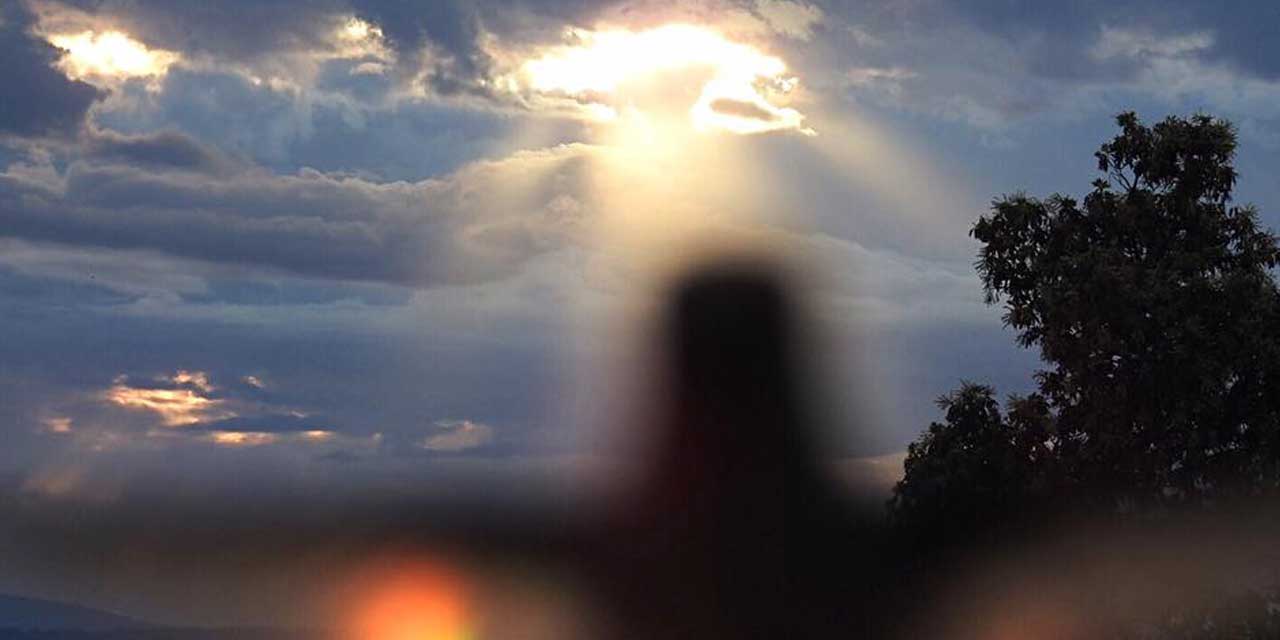
It’s Friday, which means it’s “Photo Friday” here at The B-Town Blog, and today we’re featuring Burien Photographer Rosemary Bannon Tyksinski, PhD, who goes by the Flickr name “Preconscious.”

A longtime Burien resident (36 years), Rosemary says she “loves the 3 P’s: Philosophy, Psychology, and Photography.”

She’s a Doctor of Psychology, and has been practicing in Bellevue since 1991 (more info on her practice here: www.rosemarys-office.com).

Rosemary shot the following wonderful, moody images at Seahurst Park Beach between 4:55pm – 5:30pm on Feb. 21st using a Canon EOS 5D Mark II with a 24-105mm lens set at 24mm at F/4 ISO 100:

Click to Play
Click to Play Preconscious’ Slideshow

(can also be viewed on Flickr by clicking here)

PREVIOUS PHOTO FRIDAYS:

[EDITOR'S NOTE: Photo Friday is a new weekly feature here at The B-Town Blog. Are you a local Photographer? Have some pics shot in Burien you think we should showcase? Or just some amazing photos worth sharing with our Readers? Please email us a link and explanation and we'll consider posting yours!]

BTB Contributor Gregory Rehmke sent us this photo of Tuesday’s (Mar. 16th) impressive double rainbow that struck late in the afternoon over Lake Burien.

A nice image to just stare at and imagine the science of moisture particles being struck by sunbeams causing a wonderful prism of colors that delight the human eye, thus causing various chemicals in the brain to react, sometimes creating a sense of wonderment and oftentimes, happiness.

Or…on this St. Patrick’s Day, this’ll make you think of Leprechauns and pots o’gold in B-Town.

Did you see this yesterday?

Click image to see larger version.

On Friday (March 12), we received the following email from BTB Reader Jessica, who was concerned about what she thought was a S.W.A.T. team busting down the door of a Burien house on SW 143rd:

On my way home today at approximately 4:30 I saw about 12 swat team members marching up SW 143rd st. from 4th Ave.

With guns drawn and a battering ram they broke down the front door at XXX SW 143rd Street (ED. NOTE: address removed).

I snapped a photo from my phone and you can vaguely make out the swat team entering the house (see photo below).

As a resident of the neighborhood I am hoping you can find the reason behind this type of police work.

Thank you,
Jessica

Here’s Jessica’s cell phone pic – it’s hard to see clearly, but it appears that something’s going on at the front door:

We contacted Sgt. John Urquhart, Public Information Office of the King County Sheriff’s Department, who sent us this reply:

Not the SWAT team.

One of our neighborhood narcotics units.

The search warrant was for drugs and some cocaine was found.

The resident, age 43, was booked on felony drug charges.

That’s about it.

So, there ya go – it was just another major drug bust, not the S.W.A.T. team.

Just another day in Burien, huh?

Since it’s Photo Friday here at The B-Town Blog, what better way to continue our exploration of one of our favorite arts than by showcasing an interview done by one Photographer (Francis Zera) with another (Jason Smith)?

Seattle photographer Jason Smith recently opened a show of his work at Burien’s Vino Bello (636 SW 152nd St.). Jason works as a photographic printer, as in, the old-school method of making prints using darkrooms, enlargers, vats of stinky chemicals, and fiber-based archival papers. There’s nothing digital about the work in this show, but that doesn’t make it anachronistic, rather, the prints offer a timeless look at ordinary (and sometimes extraordinary) objects and situations.

Professional Photographer Francis Zera was fortunate enough to be able to spend some time with Jason as he hung the art at Vino Bello, as well as during the show’s opening night, where he took some time to talk about his inspiration for the show, which we now present in this SoundSlideshow:

Click to Play
Click to Play Francis Zera’s SoundSlideshow

Well, 2009 was a year wasn’t it? And now that it’s over, it’s time for us to find another way to reflect on it – this time courtesy Photographer Michael Brunk, who put together a special SoundSlideshow of what he considers the best B-Town Blog photos of the year, as shot by himself, Scott Schaefer, Francis Zera, Maureen Hoffmann, Janet Grella and Gregory Rehmke:

Click to Play
Click to Play Michael Brunk’s SoundSlideshow

On Halloween (Saturday, Oct. 31st), the annual “Boo In Burien” took place, where children went trick or treating from business to business, dogs (and kids) in costumes paraded, and wiener dogs raced against each other.

This year’s event was sponsored by Discover Burien, Prudential Northwest and Grocery Outlet.

The B-Town Blog was there of course, and Photographer Michael Brunk captured these photos:

Click to View Michael Brunk’s Photo Slideshow

If you see yourself (or your dog or child) and want to download a FREE high-res version of the photo suitable for printing or emailing, click here and browse the photos on Flickr. Once you find something you like, download it by clicking on “All Sizes” just above the image, then right-click and “Save As” the JPEG in whatever size you prefer (Large and Original are best for printing).

From BTB Contributing Photographer Gregory Rehmke comes this gorgeous shot of Monday morning’s sunrise over Lake Burien – a great image to help you focus yourself for the start of another week:

We usually only post sunset pics when they’re spectacular, and Wednesday night’s (Oct. 7th) was no exception – lots of purple, orange, blue, red and…GREEN???

How often do you see green sunsets on this planet?

Here’s a photo taken by Scott Schaefer:

(click on image to see larger version)

We’re not saying that the 102.9-degree heat recorded Wednesday, July 29, 2009 was the hottest day ever.

No, that would be pretentious of us to think that it’s never been warmer here (since 1891 is when records started being kept, and there was plenty of weather history before then, right?).

With that said, can you FLIPPIN” BELIEVE HOW FLIPPIN’ HOT IT WAS TODAY???

104 degrees?

IN BURIEN???

Okay, so now that it’s cooled down a bit (and our keyboard isn’t drenched in sweat), we’d like to share some pics that BTB Readers sent us after we asked for “hot temp” pics (sorry, we’re only sharing the G-Rated stuff…and thanks gang, keep sending us more of those special pics!):

From Reader Carrie Rasmussen comes these photos of cookies being cooked in the back window of her Nanny Gloria’s car:

That's right...those are chocolate chip cookies baking in the rear window of a car.

And here they are...chocolate chip cookies. Freshly baked. In a CAR.

From Reader Candice Packer comes this pic of a truly-retro Honeywell thermostat showing that today’s temp was totally off the chart:

Our own Mini Cooper Blogmobile recorded the following 104-degree temp whilst overheating in downtown Burien:

BTB Photographer Francis Zera appears to have won the “hottest place” contest with this shot of his thermometer hitting 106.2!:

Francis’ prize of course is a duct-taped-patched down snowcoat we found at Value Village for $4.99, which he will be required to wear everyday (zipped up to the neck) until summer ends.

In the meantime, if you have any hot weather pics (wink wink), send ‘em our way. We’ll be posting more until we pass out from heat exhaustion.

The patented B-Town Blog Weather Rock™® (ok, so it’s not really a rock but we bet there’s quartz inside there, plus, that sounds waay cooler than a “Digital Thermometer”) shows proof that yes, the outside temp has hit 100 degrees in Burien, specifically outside our office window in Olde Burien.

Hey…remember during the big snowstorm last December, when everyone sent pics of how much snow they had in their yards?

Let’s do that again, only this time please send pics of the temp on your Weather Rock (aka “digital thermometer”; heck, we’ll even post analog ones) to us and let’s see who’s got the hottest yard!

Email us here.

Now, enjoy this photo and remember this record-setting day/week; and do you think it’s going to get much hotter?:

On Friday (July 24th), the King County Sheriff’s Department released the surveillance photo below of the car driven by suspects in the June 24th shooting that left an 18 year-old man dead in SeaTac:

The vehicle is thought to be a white BMW 5 series or 7 series with a sunroof.

The photo was taken by a nearby security camera just moments after the shooting.

The incident occurred around 11:30pm, and the victim was in the backseat of a car that was southbound on Military Road South. Four friends were with him. A second vehicle (a white BMW) began following them, but turned off at South 140th. As it did, several gunshots were fired and the man was hit.

The men drove straight to Highline Hospital and the victim collapsed in the entrance to the Emergency Room. He was pronounced dead shortly thereafter.

The dead man is from California and was in the area visiting relatives.

If anyone recognizes the vehicle or has information on the shooting they are asked to call the King County Sheriff’s Office immediately at (206) 296-3311 (24 hours) or 9-1-1.

Three Tree Point resident Alex Sasonoff sent us this photo he took of what appears to be a very large Lion’s Mane Jellyfish washed up on the beach in Burien last weekend (his dog Dottie is in the pic to show scale):

“It was the largest I have ever seen on the beach – three and one half feet in diameter. I measured it,” Sasanoff said.

And yes, the world’s largest jellyfish do sting – just check out the colorful red and orange tentacles on that guy.

According to Wikipedia:

Lion’s Mane Jellyfish is the largest known species of jellyfish in the world.

Its range is confined to cold, boreal waters of the Arctic, northern Atlantic and northern Pacific Oceans, seldom found farther south than 42°N latitude.

The Arctic Lion’s mane jellyfish is one of the longest known animals; the largest recorded specimen had a bell (body) with a diameter of 2.3 m (7 feet 6 inches) and the tentacles reached 36.5 m (120 feet). It was found washed up on the shore of Massachusetts Bay in 1870. This specimen was longer than a blue whale, which is commonly considered to be the largest animal in the world.

A common species, the lion’s mane jellyfish is well known to divers for its painful, but seldom fatal stings; they are toxic and can cause severe burns. Most encounters cause only temporary pain and localized redness. Although this species is potentially dangerous, only one person has ever been reported to have been killed by this type of jellyfish.

Here’s a video of one of these guys swimming in TTP waters that we previously posted from Youtube user and area diver m4jwilliams:

YouTube Preview Image

BTB Reader Kathi Vallade sent us the photo above, which she took at Saturday’s Burien Town Square grand opening celebration; here’s what she had to say about it:

OK…So I was at the Burien Town Square opening today and snapped this random picture of this girl walking by because I thought her hair was adorable! (It had a few different colors in stripes,kind of like a rainbow…SUPER CUTE!)

ANYWAYS, when I got home and uploaded the pictures I noticed it looks like I may have captured her Aura! (Cool huh?!)

I would love to find her to show her the photo but HOW on Earth do you go about finding a complete stranger ?!

(And how weirdo does it sound “Hi, I took your picture at random and saw this interesting glow around you and just HAD to track you down!”)

So…is the light around the girl’s head her “aura” or just lens flare?

We sent the original, uncropped photo to our Photographer Michael Brunk, who studied it – here’s his take:

Having seen the uncropped original, I’d say this is almost definitely lens flare.

It was taken around 12:30pm according to the meta-data, so the sun was starting to burn through the clouds about that time. You can see the camera was pointing slightly up and to the right, which angles the lens towards the bright natural light bouncing off the clouds. And this was shot with a Canon Powershot A720 so it most likely did not have a lens hood on which would tend to help prevent lens flare.

This thread has a couple of examples of lens flare that look very similar to the photo you sent. It’s just a fluke that in this case, the visible artifact is centered on the girl’s head:

http://photography-on-the.net/forum/showthread.php?t=465848

So…what do YOU think? Is that an “aura” or just lens flare? Please Comment below…

Courtesy BTB Contributing Photographer Gregory Rehmke comes this pic taken during Sunday’s -3.4 minus tide looking south toward Three Tree Point from Eagle Landing Park:


(click photo to see full size)

Monday, May 25th, the low tide will be -3.8 at 12:07pm.

Tuesday, May 26th, the low will be a -3.9 at 12:54pm.

So get out there, find some cool stuff and send us pics!

New York Times best-selling author Robert Dugoni held a book-signing at Burien’s Tin Room Wednesday night, with around 100 fans packed in for a meet and greet and autograph session from the writer of “Wrongful Death,” a suspense novel with many scenes set in this area, including The Tin Room.

Here’s a slideshow from Photographer Michael Brunk:

Click to View Slideshow

To read more of our coverage of Dugoni’s latest book and the scenes set in the Burien area, including a video, click here.

Toke, er we mean Tip of the bong, er Hat to BTB Reader and local Writer/Talent Don Crawley, who alerted us to this humorous message on the Grocery Outlet sign on 4th Ave SW near SW 150th.

We’ve always thought this store was crowded because of the bargains, but now we know the real reason: it’s Burien’s Spring Pot Sale!

Some other bad attempts at lame pot humor come to mind, like:

  • “No wonder those shoppers are buying such large quantities of Twinkies…and they’re so mellow!”Don Crawley
  • “Clean up in aisle three – the entire stack of discount munchies have been spilled again!”
  • “Now we know why this area is called HIGHline!”
  • Listen closely to the Muzak that’s played in the store next time you’re there – nothing but Grateful Dead and Phish.
  • Look closely at the name of the espresso stand in the background – it’s called “Red Eye Expresso” for a reason!

Have any pot-related joke ideas?

Dump ‘em in Comments below, ‘cuz we could all use a chuckle now and then…

UPDATE 9/1/09: An email tip leads us to believe that Burien Nissan will be re-opening in mid-September – read the latest here.

As of Monday, March 30th, Burien Nissan’s lot remains empty of any new car inventory, and according to Sales Manager John Antonelli:

“It’s still business as usual. Should have some good news on financing in a few weeks…”

As we first reported March 13th, the longtime Burien auto dealer’s inventory was carted up around March 11th when several auto carrier trucks came in and hauled away around 100 new Nissan vehicles. Apparently their “flooring” (financing) fell through with the finance arm of Nissan.

This dealership, which recently underwent a $5 million remodeling, is owned by Rainier Automotive Group. Rainier also owns Auburn Nissan, which sits in a similar state. Their websites (Burien Nissan, Auburn Nissan) make no reference to any problems, but at this lot they laid off 30 employees and they still have no cars to sell.

However, if you’re a customer, you should know that Burien Nissan is still open for both Parts and Service Monday through Friday, from 7:30am to 6pm.

PREVIOUS COVERAGE:

Photo taken by Scott Schaefer, on a recent cold spring night in Olde Burien:

Doncha just love it when signmakers run out of letters and have to get creative?

But can an “F” really substitute for an “E“?

Yeah, we don’t think so either…so we give this Burien signmaker an “F” make that an “E” seeing that’s the letter they need most.

I guess their drfams won’t comf truf either.

Courtesy BTB Contributing Photographer Gregory Rehmke comes this great photo of a rainbow over Lake Burien, taken around 6:15pm Monday night as a squall of rain passed through as the sun kept shining.

Some refer to these somewhat odd weather moments where it’s raining while sunny out as “The Devli’s Getting Married” or “The Devil’s Beating His Wife” (we’re partial to the former).

We’re wondering…what do you call it? Have an unusual saying for it?

Please Comment below…

Tuesday night (Feb. 24) at the monthly Arts Commission meeting, Mayor Joan McGilton (right) presented the Burien Community Leader Award to Dane Johnson and Kathy Justin. The presentation was given early because Dane and Kathy will be on vacation when the Awards Dinner takes place Friday March 6th.

by Gina Bourdage

Founders of the year-long Burien/ Interim Art Space (B/ IAS) experiment, combining and transforming the concepts of art, temporary green spaces, and community gatherings, Kathy Justin and Dane Johnson have thrown open the doors of Burien, welcoming in the arts community.

“The goal is to get everyone more involved. All groups from different walks of life are invited to be creative and take advantage of the space.” Said Johnson.

Kathy and Dane hope that community members, groups and artists will bring their “out of the box” interpretations for use of the space. The Interim Art Space is just the kick off as they hope to continue to bring more art for display on the streets and parks of Burien.

“We want artists to know Burien is very accessible to the artist.” Said Dane.

“The allure of a city is that your voices are more readily heard in a community this size.” Said Kathy.

Their persistence while working on Burien’s’ 15th anniversary celebration provided building blocks for a great relationship with the city, while opening dialogue that has helped grow the local arts community.

Both Dane and Kathy said that they are grateful to receive the 2009 Community Leader award, and while they will not be able to attend the awards presentation, they will be speaking as representatives of the National Burning Man Association in San Francisco on the night of the event.

Kathy and Dane are looking for volunteers and participants in the arts planning committee as event planners and coordinators, artists and more. If you are interested or to learn more visit www.interim-art-space.com.

Here’s what the award committee had to say about Dane and Kathy:

“With their amazing energy, collaborative effort and never ending persistence, they brought together artists, business owners, community members and city staff to create a temporary art space, the first of its kind in the US.

Their vision and countless hours of work have given the Burien community an incredible space that will continue to develop over the next year; planned an opening celebration that made locals and outsiders rethink Burien, and a stream of publicity that is putting Burien on the map as an arts city.”

Here’s a video (shot by Steven Bradford) of the results of their hard work from the opening night of B/ IAS on Jan. 24th:

YouTube Preview Image

We’ve had the pleasure of seeing these two talented residents in action working like dogs, and we’d like to extend a hearty-yet-arty “Way to Go!” to them from The B-Town Blog!

BTB Reader Sally Irvine sent us the photo above, of herself feeding an apparently lost male Golden (aka “Chinese”) Pheasant bird Thursday in the Hurstwood neighborhood of Burien.

Sally says:

“I live in Hurstwood and have been visited by a Golden Pheasant, he ate out of my hand today.

The zoo thinks he is most likely an escapee from someone’s private aviary. I would like to try to find his owner so a coyote doesn’t get him.”

According to Wikipedia, the Golden Pheasant is:

“…native to forests in mountainous areas of western China but feral populations have been established in the United Kingdom and elsewhere.

The adult male is 90-105 cm in length, its tail accounting for two-thirds of the total length. It is unmistakable with its golden crest and rump and bright red body. The deep orange “cape” can be spread in display, appearing as an alternating black and orange fan that covers all of the face except its bright yellow eye, with a pinpoint black pupil.

Males have a golden-yellow crest with a hint of red at the tip.

Despite the male’s showy appearance, these hardy birds are very difficult to see in their natural habitat, which is dense, dark young conifer forests with sparse undergrowth. Consequently, little is known of their behaviour in the wild.

They feed on the ground on grain, leaves and invertebrates, but roost in trees at night. Whilst they can fly, they prefer to run: but if startled they can suddenly burst upwards at great speed, with a distinctive wing sound.

Although they can fly in short bursts they are quite clumsy in flight and spend most of their time on the ground.”

So, has anyone out there lost a male Golden Pheasant?

If so, please email us immediately and we’ll connect you with Sally, who will help you retrieve your bird.

According to the FBI, Thursday morning (2/12/09) around 10:45am, the Burien Key Bank located at 655 SW 152nd was robbed by this man, described as a white male, in his late 20s, medium height, slim build, brown hair, with a goatee::

According to police, he entered the bank, gave a teller a demand note, got money, then took off.

No weapons were displayed and there were no injuries.

If this bad guy looks familiar, you are asked to contact the Seattle FBI immediately at (206) 622-0460.

UPDATE 2/13/09: Michele Smith, who runs the Vino Bello Wine Bar nearby, sent us this comment:

Didn’t this just happen?

Last Spring as I pulled up to open my shop, the block of 152nd and Ambaum was filled with King County Sherriff’s and Burien Police cars, the Key Bank was being robbed and officers were running up and down the sidewalks in riot gear with automatic weapons like on one of those cop shows you watch on TV.

And then it happened again yesterday, it’s pretty unnerving.

Isn’t this the 4th bank robbery in Burien is less than a year?

You’d think Burien might put more patrols out – just a thought.

Found the receipt above recently and just had to scan and post it – does this mean that the Burien Pizza Hut is doing customer profiling of some kind?

“LADY WITH 2 KIDS”???

Is this stereotyping?

Or some kind of Homeland Security code?

But more importantly, what does the phrase “THNAKYOU PAID” mean?

Have you ever been profiled like this while ordering a half cheese/half pepperoni pizza before?

UPDATE NOON 2/4/09: Calm down folks – this was just a joke! Did you *really* think we were serious? Regardless, now we’re thinking of SUING! Ha.

Jan ’09
29
4:00 pm

The amazingly cool 360-degree view of the new Tukwila Sound Transit Link Station is courtesy Burien’s own Francis Zera Photography / zeraphoto.com, created for his client PCL Construction (requires Quicktime to view; just click and drag your mouse/pointer over the photo and you’ll soon be dizzy from your view).

Speaking of Sound Transit, there’s an Open House this Thursday, Jan. 29th from 4-7pm for the Tukwila Station, and here are the details:

The Federal Transit Administration (FTA) and Sound Transit (the Central Puget Sound Regional Transit Authority) are issuing an Environmental Assessment (EA) under the National Environmental Policy Act (NEPA) for Tukwila Commuter Rail Station.

A public hearing/open house on the Tukwila Commuter Rail Station Project and environmental documentation will be held from 4-7 PM on January 29, 2009 at the Embassy Suites located at 15920 West Valley Highway in Tukwila, Washington.

For further information on the hearing and the project, contact Paul Cornish, Sound Transit Project Manager at (206) 398-5342, or Steve Kennedy, Senior Environmental Planner.


View Larger Map

Here’s a photo sent to use by Burien resident Bob, an Englishman who has been filing reports for us from Washington, DC, where he attended the Inauguration of Barack Obama:

This is the view Bob had from the Silver Ticket section as Obama was about to be sworn in by the bumbling Supreme Court Justice Roberts.

Look for Bob’s full report soon…

Pam Patty, a happy customer, and Mark Minium (of BTB Advertiser Burien Honda) take a break at Tuesday night’s Inauguration Party at The Mark Restaurant. The joint was so busy that Mark ended up volunteering some precious “day of service” time bussing tables to help out.

Only patches of snow remain in the Burien area Saturday (some side roads may still be slushy), and proof that it is melting lies above in the sad crime scene photo of a one-time Snowman’s remains found on an area lawn.

But fear not B-Towners, for we all know that Frosty will return again.

The only question remains: how soon?

What we do know is:

  • The rain will continue for the next several days with highs in the 40s.
  • A Flood Watch is still in effect for small streams in King County; here’s the warning from the National Weather Service:

Rain locally heavy at times will persist through tonight. Rainfall amounts of a half to one inch with locally higher amounts on the coast are likely by Sunday morning. This combined with melting snow across The Lowlands or elevations below 2000 feet will likely result in some urban or small stream flooding. Residents in urban areas are strongly encouraged to clear any blockages of storms drains before it causes flooding problems.

Excessive runoff from rain and snow melt will cause ponding of water on highways… streets and underpasses… in urban areas with poor or overwhelmed drainage… and will also cause elevated levels on small creeks and streams.

Do not underestimate the power of flood waters. Only a few inches of rapidly flowing water can quickly carry away your vehicle.

Courtesy BTB Contributing Photographer Gregory Rehmke comes this nighttime photo of Lake Burien, which appears to have thawed out, as well as grown some seasonal sparkling lights and an airport tower in the upper right corner…

Have any cool photos to share?

Please either email us or add ‘em to our Flickr Group so we can share them!

We’re taking some time off to spend with our familes,
so look for the next update on Dec. 26th!

Lake Burien is still partially frozen Wednesday morning, with a fresh dusting of scenic snow. Photo by Gregory Rehmke.

Looks like we’re in the icky weather transition period where the snow turns into rain (depending on where you live – we’re near the water and it’s raining here), and the roads become a huge slushy mess – a perfect day to clear any and all storm drains near your house, as the next phase will involve lots of water.

There’s still a Winter Weather Advisory in effect until 4pm today:

The Winter Weather Advisory is now in effect until 4 PM PST this afternoon.

Snow is expected to continue this morning. By late morning or early afternoon the snow will change over to rain in locations below 500 to 1000 feet. The higher hills continue with snow through this afternoon.

Up to two inches of new snow is possible before the change over to rain. Higher amounts are possible on hills above 500 to 1000 feet.

Snow showers could bring additional accumulations late tonight and on Christmas day.

Precautionary/preparedness actions…

A Winter Weather Advisory for snow means that periods of snow will cause primarily travel difficulties. Be prepared for snow covered roads and limited visibilities… and use caution while driving.

Here’s a reminder from BTB Reader Stephanie Breslin, who sent us the photo above – please refill your bird feeders during winter weather:

This might be a good time to remind people to fill their bird feeders and as is demonstrated here check them to make sure they didn’t ice up over night!

The normal food source for our feathered friends under the ice and snow or frozen on the trees…

Lake Burien is partially frozen! Photo taken by Contributing Photographer
Gregory Rehmke
at 8am, Sunday, Dec. 21, 2008.

Nice way to wake up to Winter Solstice huh?

Between 3-5 inches of powdery, icy new snow, on top of the previous 4-5 inches…perfect day to play outside and enjoy this rare event.

Some interesting tidbits about last night’s storm:

  • The snow is very crunchy, due to its heavy ice content.
  • Some roads have been plowed and sanded, but please don’t try to drive unless you really must.
  • To see live road conditions via webcam feeds, go to our Webcams page and refresh the page to see the latest images.
  • According to the National Weather Service, a record low was tied at Sea-Tac Airport: “A record low temperature of 14 degrees was set at Seattle-Tacoma Airport yesterday. This ties the old record of 14 set in 1990. A record snowfall of 3 inches was set at Seattle-Tacoma Airport yesterday. This breaks the old record of 1.7 set in 1951.”
  • Metro and Sound Transit buses are operating on a very limited schedule Sunday – about half their usual service. However, there will still be runs to today’s Seahawks game (including the Sounder trains which are experiencing NO delays), which should be fun as long as they leave the snow on the field. Check Metro’s regular website, their Seahawks Shuttle one, or Sound Transit’s for full details.
  • Sea-Tac Airport travelers had many problems due to the storm, ranging from delayed or cancelled flights to being stuck in the airport with no available hotel rooms. KOMO News says: “A miserable combination of cancelled flights, hazardous weather conditions and heavy passenger volumes added up to one giant migraine for many travelers at Sea-Tac International Airport on Sunday. Thousands of people arrived at the regional hub airport only to learn that their flight had been cancelled, then couldn’t find transportation back home.”

Also, here’s the latest Winter Weather Advisory (downgraded from a Winter Storm Watch):

… Winter Weather Advisory in effect until 4 PM PST this afternoon… Winter Storm Warning is cancelled…

The National Weather Service in Seattle has issued a Winter Weather Advisory… which is in effect until 4 PM PST this afternoon. The Winter Storm Warning has been cancelled.

Snow showers will continue today over the area. Intermittent freezing rain from Everett southward this morning will come to an end as a front moves through the region. An organized band of showers will move across western Washington late this morning into the afternoon hours. Up to two inches of new snow is possible by late this afternoon. In addition… this morning ice accumulation up to a quarter of an inch is also possible.

A Winter Weather Advisory means that periods of snow or freezing rain will cause travel difficulties. Be prepared for slippery roads and use caution while driving.

Have any cool snow/ice photos to share?

Please either email us or add ‘em to our Flickr Group so we can share them!

We often glance out the window and check for snow by looking up at the street light in front of our house to see if there are still flakes falling.

Imagine our surprise when we looked up around 10pm Saturday night (Dec. 20th) to see this – icicles forming on the actual street light itself:

Here’s the latest National Weather Service Winter Storm Warning:

A Winter Storm Warning remains in effect until 10 am PST Sunday.

Periods of snow will continue across the area overnight. Storm total snowfall amounts of 6 to 12 inches are likely… with  lesser amounts along the I-5 corridor from Tacoma northward. Localized gusty winds will also result in some blowing snow.

The snow has changed over to freezing rain on the central coast and will probably change over to sleet or freezing rain over the southwest interior… including the lower Chehalis valley… later tonight or Sunday morning. Elsewhere snow will continue through Sunday morning.

“Frozen Downspout” by Scott Schaefer, taken at 11:45am 12/19/08, 3 Tree Point.

12/19/08 1:30pm UPDATE: The Snow Day continues, with the temp still hovering around 29 degrees, and here’s the latest:

  • All schools are still closed. None have re-opened.
  • Buses still operating at low capacity. Walk instead. Check Metro’s “Ice & Snow Status” website (or call 206-553-3000) Metro says they will be providing bus service only on cleared highways and arterial roads, and to major transit centers and park-and-ride lots, with little service on side streets and in smaller neighborhoods. Also check Sound Transit’s website.
  • The City of Burien is still closed.
  • Most roads are still extremely dangerous, but many main ones have been sanded (including Maplewild SW outside our house).
  • Many business are actually open.
  • Many weekend events are still going on – check the Event Calendar on the right sidebar for the latest.
  • Weatherfolk are still predicting another, much-worse storm hitting the area Saturday night/Sunday morning!

AREA ROAD CLOSURES/HAZARDS:
From the city’s website:

Burien road conditions are deteriorating. Please drive with only if necessary and with extreme caution

Road crews concentrate on getting and keeping primary routes (like 1st Ave S) plowed. Once the snow stops and the primary routes are clear, crews move to the secondary routes and then neighborhood roads. Following the plows are the sanders to provide traction on the ice. Snow plows’ rubber blades do not remove ice.More details about priority routes can be found on our Snow & Ice Routes Map [PDF].

OTHER ROAD CLOSURES:

  1. CLOSED: The entrance to SR509 at 5th Ave South @ 11248 North in Boulevard Park due to ICE HAZARD

OTHER CLOSURES:
BURIEN CITY HALL IS CLOSED TODAY
Due to current road conditions and safety concerns Burien City Hall and the Burien Community Center are closed today. More severe weather is expected over the weekend, including high winds. Please prepare for possible power outages as well as continued cold temperatures.

All Burien Parks and Recreation Programs & Rental are canceled for Friday, December 19th. Call (206)988-3700 for updated information.

GARBAGE RECYCLING COLLECTION:
Far as we can tell, no garbage/recycling will be collected until next week; from Waste Management’s website:

Due to severe road conditions, we have stopped collection of ALL residential routes in the City of Burien. As such, very few homes were actually collected. We will collect “double the amount” on their next regularly scheduled colleciton day.

ONLINE RESOURCES:

LATEST WINTER WEATHER ADVISORY (as of 7:58 AM PST) – BIG SNOW/WIND STORM DUE SAT. NIGHT:

… Winter Storm Watch in effect from Saturday evening through late Sunday night…

The National Weather Service in Seattle has issued a Winter Storm Watch for most of the western Washington lowlands and the Olympics… which is in effect from Saturday evening through late Sunday night.

This developing winter storm will be different from the storm that brought snow to western Washington Wednesday and Thursday. As always happens with snow storms over western Washington… the winds interacting with terrain will determine where the heaviest snow accumulations will occur… as well as which areas will receive very little snow accumulation.

Strong east winds will predominate Saturday through Sunday. This means that the heaviest snow accumulations will most likely be over the Kitsap peninsula and along Hood Canal… where the east winds will enhance the snowfall by creating upslope conditions as they encounter the Olympics. Snow accumulations here could range from 6 inches to a foot and a half.

Another location where east winds may enhance the snow is along the western Strait of Juan de Fuca and the north coast where 6 to 15 inches is possible.

The track of the frontal system across southwest Washington and Oregon means greater snow fall will occur over the southwest part of western Washington. Snow accumulations of 4 to 10 inches may be possible over the southwest interior and the central coast. In addition… local sleet and freezing rain is possible as warm air aloft from the system moves overhead. Parts of the immediate coast may change to rain Sunday morning.

There will be a rapid drop off in snow accumulation as you move east and north of central Puget Sound. The strong east winds affecting The Lowlands east of Puget Sound will limit snow accumulations so that anywhere between a trace of snow and two inches is possible. The Seattle-Tacoma Metro area is in the transition zone between the Kitsap peninsula and areas east of Puget Sound… so snow accumulations are especially uncertain.

Total accumulations here through Sunday afternoon could range from a trace to 4 inches.

This storm will be weakest over the northwest interior… and early on in the storm… snow will be light. However snow may pick up later Sunday as the upper level low trailing the main front begins affecting the area. The San Juan Islands and the Admiralty Inlet area including Whidbey Island could see anywhere from 2 to 5 inches of snow.

At this time… the areas that look to be least affected are the Everett area northward through western Whatcom County. These areas have been left out of the Winter Storm Watch for now. Snow accumulations here through Sunday may range from a trace to two inches.

Precautionary/preparedness actions…

A Winter Storm Watch means that heavy snow is possible but not yet certain. The watch functions as advance notice of the possibility of significant snow… allowing people and communities to make preparations ahead of the event. Monitor weather forecasts and Road conditions. Delay travel if possible.

Have any cool snow/ice photos to share?

Please either email us or add ‘em to our Flickr Group so we can share them!

“Blurry, Snow Bokeh” courtesy Flickr Photog Michael Brunk

Some recaps and updates on this wacky Brrrien snow “event,” which appears to be winding down.

First, this urgent street closure update from the City of Burien, as of 12/18 8pm:

Road conditions
• SW 160th St. closed-Use 8th Ave SW to access Highline Medical Center ER
• Southbound Ambaum Blvd is closed at SW 116th St. One lane is open northbound Ambaum Blvd
• 1st Ave S from SW 152nd St to SW 156th is currently CLOSED
• SW 156th St from 1st Ave SW to 4th Ave SW is currently CLOSED

Burien road conditions are deteriorating. Please drive only if necessary and with extreme caution

Road crews concentrate on getting and keeping primary routes (like 1st Ave S) plowed. Once the snow stops and the primary routes are clear, crews move to the secondary routes and then neighborhood roads. Following the plows are the sanders to provide traction on the ice. Snow plows’ rubber blades do not remove ice.More details about priority routes can be found on our Snow & Ice Routes Map [pdf].

Secondly, tomorrow’s school closures (Fri.12/19) – far as we can tell, every school is closed, so have fun kids:

  • Highline Public Schools: CLOSED
  • Seattle Public Schools: CLOSED
  • John F. Kennedy High School: CLOSED
  • St. Francis of Assisi: CLOSED
  • Hamlin-Robinson School: CLOSED
  • Westside School: CLOSED
  • Tukwila Public Schools: CLOSED
  • Federal Way School District: CLOSED

Here’s the updated, yet sadly “expired” winter weather advisory (as of 6:19pm 12/18):

... Winter Weather Advisory for Everett and vicinity… the Seattle and Bremerton areas… and the Admiralty Inlet area has expired

The Winter Weather Advisory for snow is no longer in effect. The snow showers had ended or tapered off to flurries… thus additional significant snowfall accumulation was unlikely.

Precautionary/preparedness actions…

Those planning travel in the advisory area should be prepared for hazardous… winter driving conditions.

And now, some of our personal observations from today:

  • This afternoon, we drove to and from Sea-Tac Airport safely, but slowly (and saw lots of idiots speeding around in their SUVs…d’oh!)
  • In our ‘hood, we saw a dude snowboarding behind a truck (w/no helmet of course). That’s right – the kid was being towed by the truck, sliding around pretty quickly.
  • Another guy was cruising around in a snowmobile, towing his kids’ sled behind (if he had a glowing red schnauze we woulda yelled “Slow down Rudolph!”)
  • Favorite snow prank of the day: telling our kids to stand under a snow-covered tree and look up under the branches closely (“there’s something really cool up there”), then tossing a snowball into the branches, thus causing the accumulated snow to fall onto said children’s faces…ha.

Here are some more BTB Reader pics:

Photographic proof that 5 inches of snow fell in Seahurst Thursday; photo courtesy Stephanie Breslin, who says: “My boyfriend was measuring the snow to let me know how much had fallen since yesterday…not very scientific but I thought it was fun…”

Photo by Carol Morrison, who says: “Chico is the black cat and Nico is the grey cat. I live on 164th Place, which is parallel to Maplewild; we usually have a nice view of Vashon Island but not today!”

Have some snow photos to share?

Please either email us or add ‘em to our Flickr Group so we can share them.

The much-hyped snow has finally arrived in Burien, and it’s falling now, in case you’re stuck inside somewhere without a window.

Photo above was taken just after 9pm Saturday night Dec. 13th, and we have a feeling this light dusting may go on for a while.

But it’s not the snow that should concern B-Towners, it’s the ding-dang frigid cold blasting down out of the Fraser Valley of BC that’s going to be the problem. This big chill is being called the worst in 18 years, so everyone should take it very seriously.

After all, the National Weather Service has issued the following warning, which is in ALL CAPS:

..THE LONGEST STREAK OF COLD WEATHER SINCE DECEMBER 1990 IS ON THE WAY…WHILE THE POSSIBILITY OF LOWLAND SNOW SHOWERS IS IN THE FORECAST AT TIMES OVER THE NEXT FEW DAYS…IT IS THE FRIGIDLY COLD TEMPERATURES EXPECTED OVER THE NEXT WEEK THAT COULD HAVE THE GREATEST IMPACT ON WESTERN WASHINGTON.

AN ARCTIC AIR MASS WILL STREAM INTO WESTERN WASHINGTON TONIGHT AND SUNDAY…IN THE WAKE OF AN ARCTIC FRONT MOVING SOUTH THROUGH THE AREA THIS AFTERNOON. TEMPERATURES WILL FALL BELOW FREEZING ACROSS WESTERN WASHINGTON TONIGHT WITH MANY SPOTS DIPPING INTO THE LOWER TO MID 20S. MOST OF THE REGION WILL REMAIN BELOW FREEZING ON SUNDAY WITH AFTERNOON HIGHS ONLY IN THE MID 20S TO LOWER 30S. IN ADDITION WINDY CONDITIONS WILL ACCOMPANY THE ARRIVAL OF THE ARCTIC AIR MASS TONIGHT AND SUNDAY…ESPECIALLY IN THE NORTH INTERIOR OF WESTERN WASHINGTON.

SNOW SHOWERS TONIGHT AND SUNDAY COULD PRODUCE LOCAL ACCUMULATIONS OF 1 TO 3 INCHES…CREATING SLIPPERY ROADS AND SIDEWALKS. ROADWAYS AND OTHER SURFACES THAT ARE ALREADY WET WILL QUICKLY BECOME ICY AND DANGEROUS. THE FRIGID WEATHER COULD BURST OUTDOOR PIPES AND ENDANGER PETS AS WELL. WIND CHILL IS ANOTHER THING THAT CANNOT BE IGNORED. IN THE NORTHWEST INTERIOR THE COMBINATION OF SUB-FREEZING TEMPERATURES AND WINDY CONDITIONS WILL CREATE APPARENT TEMPERATURES NEAR ZERO DEGREES FAHRENHEIT…LOW ENOUGH TO CAUSE FROSTBITE TO EXPOSED SKIN.

TEMPERATURES WILL DROP FURTHER ON MONDAY…AS VERY COLD AIR CONTINUES TO FUNNEL THROUGH THE FRASER RIVER VALLEY OF SOUTHERN BRITISH COLUMBIA AND INTO WESTERN WASHINGTON. BY MONDAY…DAYTIME HIGHS WILL GENERALLY REACH ONLY THE 20S WITH NIGHTTIME LOWS IN THE TEENS OR LOWER. THE COLD AIR MASS WILL SIT OVER THE REGION FOR THE REST OF THE WEEK…WITH MOST ALL OF WESTERN WASHINGTON REMAINING NEAR OR BELOW FREEZING EVEN DURING THE DAYTIME. THIS WILL LIKELY BE THE MOST PROLONGED STREAK OF SUB-FREEZING WEATHER SINCE DECEMBER 1990.

IN ADDITION…A WEATHER SYSTEM ON WEDNESDAY COULD INTERACT WITH THE STUBBORN COLD AIR MASS TO PRODUCE A RENEWED THREAT OF ACCUMULATING SNOW ACROSS THE WESTERN WASHINGTON LOWLANDS. OVER THE MOUNTAINS…TEMPERATURES WILL FALL INTO THE TEENS AND SINGLE DIGITS TONIGHT AND REMAIN VERY COLD FOR MUCH OF THE WEEK AHEAD. WIND CHILL VALUES OF 20 BELOW ZERO CAN BE EXPECTED AT TIMES…WHICH WOULD CAUSE FROSTBITE TO EXPOSED SKIN IN ONLY ABOUT 15 MINUTES. PLEASE BE PREPARED FOR AN UNUSUALLY PROLONGED AND INTENSE PERIOD OF COLD WINTER WEATHER.

Photos by Janet Grella

Hundreds of kids and adults hit the streets of Olde Burien on Saturday (Dec. 6th) to celebrate Winterfest ‘08, and here are some photographic highlights:

BTB Advertiser John L. Scott served as Burien's North Pole, where hundreds of children and families had a complimentary picture taken with Santa Claus.

Next door, Robert Simpson-Clark cooked hotdogs with his assistant Olga at Jay Lauris Jewelry.

Everyone seemed to love the horse drawn wagon, leaving from in front of the Danish Bakery and touring west on SW 152nd.

The weatherman cooperated and kept the wet stuff away, making it a fun and festive day for kids of all ages.

From Flickr Photog Dougerino comes this great Burien-related pic, which he describes as:

Those golden arches were the place to hang out in ‘74, during the short-lived streaking fad.

Have a Burien-related photo you’d like to share with our BTB Readers?

Email us, or add it to the B-Town Blog’s Flickr Group here!