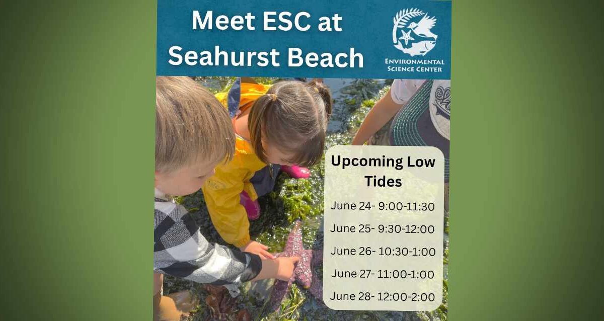
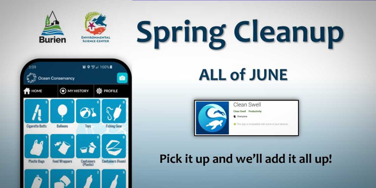
We’re pretty sure that the last time a tsunami hit the northwest coast of the U.S. was in 1964, shortly after a major earthquake struck Alaska; far as we know, it damaged some places on the Oregon coast, including Cannon Beach.
Saturday morning (Feb. 27th), imagine our surprise when we saw an “Advisory” posted in our Weather Widget in the right sidebar. Clicking on it revealed that yes, a “Tsunami Advisory” had been issued for the northern and central Washington coast after a huge, 8.8 quake hit Chile´.
We don’t think this is cause for panic in the Puget Sound region, but we wanted to share this info because, well, who knows – maybe a tsunami-based wave will hit the shorelines near Burien? Maybe not?
The advisory warns that, if indeed a tsunami wave makes it up the coast, takes a right turn through the Strait of Juan de Fuca, makes another right and heads down through the upper islands of Puget Sound…when (and if) it hits Pier 48 in Seattle it’s predicted to be .13 feet high, which, according to our rudimentary math skills, equals a measly 1.56 inches high.
According to this NOAA website, the predicted time for this wave to strike Seattle is 1641 PST – for us non-military types, that’s 4:41pm Saturday afternoon.
If you happen to have a video camera and a lot of free time this afternoon, why not hang out near one of Burien’s beaches around 4:30-5pm and see if you can videotape a 1.56 inch wave barreling in from the north? We’d love to post it – please email us if you do!
And if you know anyone who lives on the coast, or in Hawaii, please make sure they’re aware of this advisory, as it could be very serious in those areas.
According to the National Weather Service:
Persons in tsunami advisory areas should move out of the water… off the beach and out of harbors and marinas.
Tsunami advisories mean that a tsunami capable of producing strong currents or waves dangerous to persons in or very near water is imminent or expected. Significant widespread inundation is not expected for areas in an advisory. Tsunamis are a series of waves potentially dangerous several hours after initial arrival time. Estimated times of initial wave arrival for selected sites in the advisory are provided below.
Here’s the “Tsunami Advisory” language as posted at 9:18am:
Tsunami Advisory
Statement as of 9:18 AM PST on February 27, 2010
… A tsunami advisory remains in effect for the northern and central Washington coast…
A tsunami advisory remains in effect for the northern and central Washington coast.
There is no Tsunami Watch or warning in effect for the Washington coast. Repeat… there is no Tsunami Watch or warning in effect.
A powerful 8.8 magnitude earthquake occurred at 1034 PM PDT Friday near the central coast of chile. It has generated a tsunami wave… which is now spreading out across the Pacific Ocean.
The first tsunami waves are expected to reach the Washington coast between 250 PM and 310 PM PST this afternoon. The following are the
estimated arrival times of the first waves.
- Seaside or… … ..246 PM PST
- Westport WA… … .257 PM PST
- Neah Bay WA… … .307 PM PST
The largest tsunami waves are expected two hours after the first arrival.
The waves are not expected to be large enough to cause coastal flooding along the Washington coast. However… some coastal areas could experience dangerous currents and surges in harbors and bays. Forecast tsunami wave amplitudes follow.
- Long Beach WA… ..0.46 ft
- Westport… … … .0.78 ft
- Moclips… … … ..1.27 ft
- Neah Bay… … … .0.65 ft
- Port Angeles… … 0.33 ft
- Bellingham… … ..0.46 ft
- Everett… … … ..0.13 ft
- Seattle-pier 48… 0.13 ft
The minimum wave height for a tsunami advisory on the Washington coast is 6 inches or 15 centimeters.
The initial wave will not be the largest. Coastal residents are advised to stay out of the water… off the beach… and away from harbors and marinas. Wave heights and currents are amplified by irregular shoreline and are difficult to predict. The tsunami may not be visible among the common ocean surf… yet tide gages will likely report some fluctuations.
Mariners in water deeper than 600 feet should not be affected by a tsunami.
Repeat… no Tsunami Watch or warning is in effect for the northern and central Washington coast.
And just ‘cuz we found it and we love science, here’s a pretty cool simulation video of what might happen if a tsunami hit Elliott Bay:
UPDATE: 1:45pm PST: So far, no tsunami yet in Hawaii, but this type of rare event is considered and “inexact science.” Here’s a link to a website that’s broadcasting a live TV signal from Hawaii.
Also, here’s the live webcam feed from Burien’s Seahurst Park Beach, just in case; refresh this page to see the latest:

Burien residents had their final opportunity on Tuesday night (Feb. 23rd) to voice to the Burien Planning Commission their opinions and concerns about proposed rule revisions in the draft update of the city’s Shoreline Master Program.
Written comment still will be accepted, addressed to either the Burien Planning Commission or Senior City Planner David Johanson, at 400 SW 152nd St., Burien, WA, 98166, or by emailing DavidJ@burienwa.gov.
Concerned citizens will also have opportunities to speak out on the draft plan at public hearings, which will be scheduled later, conducted by the Burien City Council and the state Department of Ecology.
After hearing the last of the public testimony Tuesday evening, Planning Commission members began the process of working their way through a detailed summary of earlier comments by shoreline-area residents and draft responses prepared by city staff and consultants.
Public interest in this issue is so great – as is the level of concern among local shoreline residents who fear their property rights could be impacted by a revised plan – that the Burien Planning Commission, which will continue its review of the plan, will meet in the City Council chambers on the first floor of City Hall.
Almost 200 people, troubled primarily about the impact revised regulations – and public access to shorelines – will have on their property, crowded a smaller room for the Planning Commission two weeks ago.
But in the wake of that meeting, said several persons involved in the planning process, many of those commenting on the draft document were not well informed or were basing their concerns on “disinformation.”
Burien City Manager Mike Martin and Senior City Planner David Johanson recently sat down with The B-Town Blog to address what they said is misleading information circulating about provisions in the draft update of the Shoreline Master Program; here are their reactions:
Non-conforming structures on shoreline property cannot be rebuilt if damaged.
Martin: “That absolutely is not the case.”

Turnout was so high at the last meeting that Tuesday night's Shoreline Master Program meet was moved to city council chambers.
Martin: “It does not do that. Period.”
Rights-of-way at the water’s edge can be taken over by the city.
Martin: “Contrary to what anyone may have heard, there is nothing in the document that gives the city new authority to take over any right-of-way.
The Planning Commission will make the final decision to approve the shoreline plan.
Martin: “That absolutely is not true. The City Council will make the final decision.”
The Planning Commission is expected to deliberate on the public comment it has received, complete its review of the document, and forward a recommendation to the City Council by the end of March.
At least one public hearing will be held by the council while it considers the plan before taking final action. Once the city has adopted its updated Shoreline Management Program, it still must be reviewed and approved by the state Department of Ecology.
Because of widespread misconceptions about provisions in the draft plan, some Planning Commission members are encouraging concerned shoreline residents to read it first, and then ask questions and address specific concerns, rather than simply reacting to rumors about what purported new regulations would do to their property.
The draft shoreline plan is available on the city’s website at http://burienwa.gov/index.aspx?NID=851.
Johanson noted that updating the city’s Shoreline Master Program is not a local option. “The state requires us to do this … over 200 jurisdictions [in Washington] are doing this.”
The state requires all cities and counties to periodically update their Shoreline Management Programs, which implement the Shoreline Management Act at the local level.
According to Ecology, local plans are based on state law and regulations, but “are tailored to the unique geographic, economic and environmental needs of each community.”
This is to improve and protect the health of Puget Sound and other waterways, improve water quality and salmon recovery, and enhance the state’s economy and tourism, Johanson added.
Information about the Shoreline Management Act and guidelines for local Shoreline Master Programs is available on Ecology’s website at http://www.ecy.wa.gov.
Burien was awarded a $117,000 state grant from Ecology for this project, which began with a comprehensive review of the current document by the Shoreline Advisory Committee. The committee then made recommendations and submitted that draft to the Planning Commission.
Martin stressed that the draft revisions give the city “no new rights or authority under its shoreline document.” This includes Lake Burien, which has no public access to its shoreline.
“The city does not have any more authority in this document to provide public access [to the lake] than at any time in the past,” he said.
Johanson said setbacks allowed in the proposed revised plan, in the event of reconstruction due to property damage, are “similar to those of other urban jurisdictions” in an attempt “to strike a balance between state objectives and the urban setting” where shorelines already are developed.
The draft plan would require a 65 foot setback from the average high water level, compared to a current setback of 20 feet along the Puget Sound shoreline. If adopted, those homes would be classified as non-conforming structures – but could be rebuilt on their existing footprint if damaged.
Johanson indicated that after the Planning Commission has finished taking public testimony, staff will compile a list of frequently asked questions together with clarifications and answers, and post this on the city’s website.
Burien’s “highest priority” in updating its Shoreline Master Program should be assessing “reaches of shoreline where there is no public access,” City Councilman Brian Bennett told The B-Town Blog in a recent interview.
But Bennett, who served on the Shoreline Advisory Committee before his election to the City Council last fall, stressed that this view is based solely on his work as a member of that committee.
He vowed as a councilman to listen fairly to the concerns of all shoreline property owners when the council reviews proposed revisions to the plan later this year. He added that private property rights should be protected in the final document.
“There are certain areas of shoreline in Burien without any public access,” Bennett noted. Yet “public policy at the state and federal levels [calls for] access to public waters.”
Burien has two reaches of shoreline along “public waters” as defined by state and federal laws – Puget Sound and Lake Burien. Seahurst Park affords access to Puget Sound, and there are also limited access points at Three Tree Point.
But there is no public access to Lake Burien, and “the lake is public property,” Bennett said. “It is owned by the city and the state.”
The question to him then becomes how to create public access to Lake Burien without impacting property owners around the lake.

“I would like the community to consider limited secure access" to Lake Burien – Brian Bennett.
“I would like the community to consider limited secure access, gated with secure buffers” to the lake, he continued. This access would not allow boats and would have only “limited parking to promote people walking.”
His preferred point of access would be on lakeside parcels adjacent to the Ruth Dykeman Center that center directors hope to sell. Bennett hopes the city will consider buying one or more of these last remaining lots on the lake.
“If they are built on, there will be no opportunity again in our lifetime to gain access to the lake. It’s important for us to consider this…”
“There are kids just a couple blocks away wondering, ‘Why don’t we get to play on the lake?’” Bennett said. “It concerns me that this is a debate about us against them. It’s important that as a community we all be together helping each other out.”
He recalled that Lake Burien is considered the birthplace of Burien, and is just a block from SW 152nd Street – the city’s “main street” – making it a natural link to the downtown business district.
Bennett also said he has “heard from a lot of people” about this issue and understands their concerns. Any access to Lake Burien would have to protect the shoreline environment as well as the privacy and property of lakeside residents, he declared.
(Photo of Brian Bennett by Joe Mabel)
Longtime Burien resident and local artist Dave Branson was out and about this last weekend, spending time sketching at Seahurst Park Beach, which played a significant role in his life growing up here since his family used to own a 9-acre wooded waterfront residential lot nearby.
Here’s what Dave had to say about this sketch:
It was a beautiful sunny day Saturday, so we went to Seahurst Park, and I did this sketch while we were there.
I was young when the sea wall went up at Seahurst Park, and it’s always felt like the park’s dominant feature to me. My Dad would jog at the park regularly, and I would join him sometimes when he could pry me away from Saturday morning cartoons. I remember when the sea wall was new and the concrete pavers on the path along the top of the wall hadn’t settled yet. They were musical because they would ring a little bit when we ran along the path.
Now I’ve heard that the northern part of the wall will be removed, just like the southern wall has been. It will take some getting used to. I’m still not used to how the southern half of the park has changed. I know it’s all for the best, environmentally, and now the beach will feel like the dominant feature of the park when our family visits the park in the coming decades.
And for a little historical background on this part of Burien and the Branson family, here’s some info taken from the city’s website:
In the early 1900s, the land known as Eagle Landing Park belonged to the Branson family. The Branson property was part of a 200-acre parcel owned by the Seahurst Land Company, which supplied water to local residents from springs on the property. The original Branson estate was a 9-acre wooded waterfront residential lot. In 1915, a relative of the owner built a residence in the northern portion of the property, which was upgraded and expanded in the 1930s. A county road through the property was platted but never built, and has been vacated since 1935. The property was logged about 90 years ago, when much of the timber in Burien, Seahurst, and Gregory Heights was felled to supply wood for America’s Liberty Ships in World War I.
The steeply sloped property sits atop two geologic units – glacial lake clay and silt below, and glacial outwash sand and gravel above – both deposited during glaciation of Puget Sound in the last Ice Age. Springs trickle from the hillside at an elevation of about 50 feet. The area has a long history of slope instability, according to oral history and the topographic features of the site.
To see more of Dave’s art, check out his blog: http://popsiclemud.blogspot.com.
The City of Burien has been awarded a $750,000 grant from the state Salmon Recovery Funding Board to return the northern shoreline of Seahurst Park to a restored, more accessible, and more natural condition, with hopes it will restore salmon habitat.
The money will be used by the Parks, Recreation, and Cultural Services Department, and construction is scheduled for fall of 2010. Crews will remove a seawall, rock riprap (huh?), groins (what th–???), paving and fill.
In addition to the $750,000 grant, the City of Burien will contribute $133,000 from a state grant and the Army Corps of Engineers will contribute $1,800,000 through the American Recovery Reinvestment Act.
Since being armored in the 1970s, beach elevations in Seahurst Park have dropped 3 to 4 feet due to wave scouring and the disconnection of the beach from sources of sediment. The changes in the beach have significantly degraded the quality of habitat for salmon and the organisms they depend on, particularly forage fish.

The seawall that will be removed is visible on the far right of this pic. Photo courtesy Burien Parks.
A similar project on the southern shoreline of the park to remove the seawall and restore the beach was completed in 2005. The northern section is much larger in scale and will include recreational elements such as a playground, picnic areas and trails.
The Salmon Recovery Funding Board on Dec. 11th announced it was awarding over $2.6 million for nine projects, including Seahurst Park, to protect and restore salmon habitat in King County.
The City of Burien has been awarded a $117,600 grant from the Washington State Department of Ecology for its Shoreline Master Program.
This grant is part of a $6.3 million award to 70 Puget Sound communities, and is meant to modernize local shoreline regulations.
The neighboring city of Des Moines was awarded $133,000.
“From the San Juans to the Sound’s southern tip, 120 of the 130 local governments in the Puget Sound region are still using largely the same shoreline master programs they adopted in the 1970s,” said Ecology’s Gordon White, who oversees statewide shorelands activities. “Yet in the past 30 years, the area’s population has ballooned by nearly 60 percent. If we hope to restore, protect and preserve the Sound, we’ve got to start by managing our shoreline areas wisely.”
According to the city’s website:
Under the state Shoreline Management Act, each city and county with “shorelines of the state” must adopt a Shoreline Master Program (SMP) that is based on state laws and rules while tailored to the specific geographic, economic and environmental needs of the community.
Burien must update its current SMP by December 1, 2009, and this grant will be used for this purpose. The City and its consultants are well into updating the master program with the aid of the City’s Shoreline Advisory Committee.
For more information on Burien’s Shoreline Master Program, click here.
To view a draft of the Shoreline Jurisdiction map, click here (PDF).
To view the full list of Department of Ecology grants, click here (PDF).
| Sep ’09 |
| 13 |
| 4:00 pm |
The Burien Arts Association is holding a special “Summer Garden Party” benefit on Sunday, Sept. 13th from 3pm to 7pm at a “private beach house” in Burien.
It’s sure to be an artsy and elegant event, cost is $50 per person and space is limited so you’d better act quick.
Your tax deductible ticket will contribute to the programs and events Burien Arts presents throughout the year for the enrichment and enjoyment of area residents.
Burien Arts programming includes:
- Highline Vintage Jazz Festival
- Burien Art Gallery Lectures and Exhibitions
- Shakespeare in the Park
For more information, or to buy tickets, call (206) 244-7808 or email info@burienarts.org.

Three Tree Point resident Alex Sasonoff sent us this photo he took of what appears to be a very large Lion’s Mane Jellyfish washed up on the beach in Burien last weekend (his dog Dottie is in the pic to show scale):

“It was the largest I have ever seen on the beach – three and one half feet in diameter. I measured it,” Sasanoff said.
And yes, the world’s largest jellyfish do sting – just check out the colorful red and orange tentacles on that guy.
According to Wikipedia:
Lion’s Mane Jellyfish is the largest known species of jellyfish in the world.
Its range is confined to cold, boreal waters of the Arctic, northern Atlantic and northern Pacific Oceans, seldom found farther south than 42°N latitude.
The Arctic Lion’s mane jellyfish is one of the longest known animals; the largest recorded specimen had a bell (body) with a diameter of 2.3 m (7 feet 6 inches) and the tentacles reached 36.5 m (120 feet). It was found washed up on the shore of Massachusetts Bay in 1870. This specimen was longer than a blue whale, which is commonly considered to be the largest animal in the world.
A common species, the lion’s mane jellyfish is well known to divers for its painful, but seldom fatal stings; they are toxic and can cause severe burns. Most encounters cause only temporary pain and localized redness. Although this species is potentially dangerous, only one person has ever been reported to have been killed by this type of jellyfish.
Here’s a video of one of these guys swimming in TTP waters that we previously posted from Youtube user and area diver m4jwilliams:

Manning shovels at the Environmental Learning Center groundbreaking ceremony Tuesday were (L to R) Burien Mayor Joan McGilton, King County Executive Dow Constantine, Georgette Valle, State House Rep. Sharon Nelson, State Rep. Tina Orwall, ESC Board President Kerry Lohr, ESC Director Julie Burr, and Burien Parks Director Michael Lafreniere.
Ground was broken Tuesday afternoon (June 23rd) by numerous local and state dignitaries for Burien’s new world-class, state-of-the-art Environmental Learning Center, located at the Seahurst Park beach.
This new facility will replace the current “caretaker’s cottage” building, and will serve as a learning center where children and educators can come together to learn to understand, appreciate and protect precious natural resources, especially Puget Sound.
This future Environmental Learning Center will also be a gathering place in a stunning setting for Burien.
The City of Burien has granted a 30-year lease to remodel the old caretaker’s cottage into a state of the art facility, which will also serve as a model for green building techniques.
The mission of the Environmental Science Center is to promote environmental stewardship, sustainability and academic achievement through science based environmental education.
For more information, or to make a donation to the Capital Campaign, please visit the ESC website.
Tuesday afternoon (June 23rd) saw one of the lowest tides of the year, a -4.1, and here’s a slideshow by Photographer Michael Brunk:
Click to View Michael Brunk’s Photo Slideshow
Wednesday’s low tide will be a -3.9 at 12:40pm, so pack a lunch, take the kids and don’t forget to bring your camera!
Here are the tides through Sunday, June 28th:
WEDNESDAY, JUNE 24th:
Low 12:45 AM 7.6
High 5:27 AM 11.3
Low 12:40 PM -3.9
High 8:14 PM 12.6
THURSDAY, JUNE 25th:
Low 1:41 AM 6.9
High 6:26 AM 10.8
Low 1:28 PM -3.2
High 8:55 PM 12.8
FRIDAY, JUNE 26th:
Low 2:38 AM 6.0
High 7:30 AM 10.1
Low 2:16 PM -2.0
High 9:34 PM 12.8
SATURDAY, JUNE 27th:
Low 3:38 AM 4.9
High 8:39 AM 9.3
Low 3:05 PM -0.4
High 10:13 PM 12.6
SUNDAY, JUNE 28th:
Low 4:39 AM 3.7
High 9:56 AM 8.5
Low 3:55 PM 1.5
High 10:52 PM 12.4
Some of the lowest tides of the year will hit the beaches of Burien this week (as witnessed in the slideshow from Monday’s -3.9 above by BTB Contributing Photographer Gregory Rehmke), including a -4.1 at 11:51am Tuesday (June 23rd).
If you do venture down into the low tide zone, remember the hiking phrase “take only pictures, leave only footprints,” and please remember to not pick up or touch any of the exposed critters – just look at them, take lots of macro pictures (and send them to us), but don’t pick anything up. The intertidal zone is most likely a tough place to live, due to the daily fluctuations of exposure to water and then air.
But then again, despite our ability to re-grow a severed limb, we’re not a Seastar.
Here are the tides for this week through Sunday, June 28th:
TUESDAY, JUNE 23rd:
High 4:31 AM 11.5
Low 11:51 AM -4.1
High 7:33 PM 12.4
WEDNESDAY, JUNE 24th:
Low 12:45 AM 7.6
High 5:27 AM 11.3
Low 12:40 PM -3.9
High 8:14 PM 12.6
THURSDAY, JUNE 25th:
Low 1:41 AM 6.9
High 6:26 AM 10.8
Low 1:28 PM -3.2
High 8:55 PM 12.8
FRIDAY, JUNE 26th:
Low 2:38 AM 6.0
High 7:30 AM 10.1
Low 2:16 PM -2.0
High 9:34 PM 12.8
SATURDAY, JUNE 27th:
Low 3:38 AM 4.9
High 8:39 AM 9.3
Low 3:05 PM -0.4
High 10:13 PM 12.6
SUNDAY, JUNE 28th:
Low 4:39 AM 3.7
High 9:56 AM 8.5
Low 3:55 PM 1.5
High 10:52 PM 12.4
Sunday night (May 3rd) around 7:30pm, BTB Sales Diva Janet Grella happened to capture these images of a vivid rainbow over the water off Three Tree Point:
Janet says:
“Diva,” our Olympic swimmer wanna-be, dived into the sound and swam two miles to the end of the rainbow in Normandy Park Cove only to find a leprechaun being choked by a neighbor.
She tried mouth to mouth on the little guy only to find the swine flu of her rainbow.
Thursday afternoon (4/30) on Burien’s Three Tree Point beach saw some unusual animals at low tide – PONIES!

From left, Army Olsen, Brie Hobbs and Gigi Sferra feed local grasses to one of three ponies that were offering rides to winners of a prize from Hamlin-Robinson School’s annual auction. According to the kids, the ponies ate “just about anything, including seaweed!”
The lucky auction winners got to ride around the beach just after low tide and enjoy a picnic for about three or so hours.
Lisa Sferra (pictured below, giving her Shetland Pony Cheerio a kiss) who works in White Center, donated the rides for the school’s fundraiser. Hamlin-Robinson is located near Boulevard Park at 10211 12th Ave South.

Lisa wants BTB Readers to know that if they’re interested, they can get Pony Rides for their kids for just $40 per child (pony kisses cost extra).
She can be reached at lsferra@hotmail.com.
Monday April 27th saw one of the lowest tides so far this year, a -2.7 at 1:11pm, and Photographer Michael Brunk was on the scene at Burien’s Seahurst Park, where lots of normally-unseen Burien residents were exposed:
If you’re interested in meeting more of your normally-unseen neighbors during another minus tide, mark your calendars for:
- A -2.7 tomorrow (Tuesday, April 28th) at 1:58pm
- A -3.65 on Sunday, May 26th at 12:53pm
- The lowest tide of the year will be a -3.91 on Tuesday, June 23rd at 11:52am
| Apr ’09 |
| 1 |
| 6:00 pm |
Do you have an opinion on the proposed changes to the seawall on the north end of Seahurst Park?
If so, your chance to speak up will be at 6pm on Wednesday, April 1st, during a city public meetig to take citizen comments.
As part of the City’s long-range master plan for the park, it has been evaluating possible options for the removal of the park’s north seawall.
Anchor Environmental, which previously completed the park’s master plan, is conducting the feasibility study process, and here are some important elements to consider:
- The seawall was installed and constructed by King County in 1972.
- The park itself was purchased in the early 60s and managed by King County until 1993.
- Since 1972, when the seawall was built, much has been learned about shoreline and habitat protection. In 2002 Burien adopted the Seahurst Park Master Plan which called for over $11 million in renovation and restoration to return the park to its originally intended use, and to reverse environmental degradation.
- With state, federal and local funding, the City began removing the south seawall and grading the shoreline to improve a key migratory corridor for juvenile Chinook salmon.
- In December of 2008 the first phase was completed, including removal of the south seawall, beach restoration and marine riparian plantings. Additional work focused on replacement of the decades-old restrooms, new trails, and new picnic areas as well as repairs to the south picnic shelter.
- More info on the seawall at this website.
The public meeting will review the site assessments and recommendations for the north end of Seahurst Park prepared by the City’s consultants.
The meeting will be held at Burien Community Center, located at 425 SW 144th Street in Burien.
For information regarding this meeting and the feasibility study, contact Steve Roemer, Park Development and Operations Manager, at (206) 248-5513.
by Mark Neuman
One of our area’s hidden gems is Seahurst Park.
And tucked away at the beach there is another diamond – the Environmental Science Center.
The Environmental Science Center (ESC) is the only community-based, not-for-profit environmental education organization in south King County with programs for all ages.
With a primary focus on K through 12, ESC offers school-day programs including classroom lessons and field trips, after school programs, summer camps, and community presentations.

State Sen. Joe McDermott, ESC Executive Director Julie Burr and Burien Deputy Mayor Rose Clark.
Since its founding in 1999, rapid expansion in programs has led to an increasing number of program participants served, with more than 8,000 clients during 2008, up from 5,000 clients in 2006.
“We want to foster the next group of environmental stewards,” said ESC Executive Director Julie Burr. “Kids don’t get out there, really out-of-doors, like they used to. We reach out with special effort to minority or lower-income children.”
Julie recently spent time showing the B-Town Blog around the Center, and brought us up to speed on a big project they have in mind.
“We have a vision for an Environmental Learning Center,” Julie said. “And we have the perfect spot to build it on.”
Years ago, when Seahurst Park was the property of King County, a park caretaker actually lived in a cottage just a few yards from the building ESC currently works out of.

Guests at the campaign kickoff gathered in front of the old caretaker's cottage.
The caretaker is long gone, and the cottage is boarded up.
“We will renovate inside and expand the cottage a bit on its south side.”
The result will be a 2,200 square foot facility which will seat fifty students.
It will take about $1.3 million to fully renovate. The fundraising has been going on for a while, with $900,000 having been raised to far.
“The remaining $400,000 is proving the toughest. Several major corporations sincerely want to help, but have had to drastically cut back their civic donations” due to the current economic state of affairs.
Corporate groups who have contributed toward the Learning Center include Boeing, Alaska Airlines and Waste Management.
“We greatly appreciate, as well, our funders who help keep our regular programs running,” Julie said. These groups include:
- The Russell Family Foundation
- The JiJi Foundation
- The Bottler Charitable Trust
- The City of Burien
- The Horizon Foundation
- The Seattle Foundation
- King Conservation District, WRIA 9
Julie received a special gift last month.
“My daughter, Jesann, bless her heart, went out and raised $1,540 from her friends for the Learning Center. She didn’t tell me about her efforts at all,” Julie recalled. “Then on Christmas Day she gave me the checks. What a sweetheart.”
No gift is too small (or too big!), so if you would like to contribute, please feel free to contact Julie anytime:
Julie Burr
Executive Director
Environmental Science Center
Julieb@envsciencecenter.org
phone 206-246-2144
DIRECTIONS:: From Ambaum Blvd. go west on 144th. Turn right on 13th. That road will take you all the way to the beach, where parking is available.
The Environmental Science Center and the cottage are about 200 yards north of there.
| Jan ’09 |
| 10 |
| 7:30 pm |

Seahurst Park is having a Moonlit Beach walk this Saturday, Jan. 10th from 7:30pm to 9:30pm. There is no charge, but it will be cold so participants are asked to bundle up, bring a bright flashlight with good batteries, wading boots, warm hat & dry gloves.
Naturalists will be on the beach during the full moon at low tide to share information and guide walks.
Here’s a blurb from the Seahurst Environmental Science Center website:
Imagine you’re on the shoreline at a lovely low tide.
Rocks that are covered all year lie exposed to view while the sea animals remain happily cold and wet in the dark.
All around you, people with flashlights are intently studying the amazing and abundant sea life as local naturalists help you discover the wonders of your Puget Sound shoreline.
For more information contact Barb or Darrell Williams at (206) 901-1964.
This seal pup was spotted and photographed on the beach at Three Tree Point Sunday afternoon Oct. 19th around 3pm:


According to the Washington State Department of Ecology:
If you see a harbor seal pup alone on the beach, do not disturb them It’s the law.
Human encroachment can stress the pup and scare the mother and other adult seals away.
For your safety and the health of the pup, leave the pup alone.
Do not touch!
Do not wrap a pup in blankets (seals are protected by blubber and blankets will cause it to overheat.)
Do not try to feed a pup. (Incorrect feeding can cause a pup to die.)
Do not try to force a pup into the water.
Keep pets and children away from a pup.
Shortly after these photos were taken, several neighbors who were watching from a safe distance decided to scare the pup back in the water, citing previous experiences where the babies have ended up being “baked” on the beach and passing away.

Join a project that’s been going strong in Normandy Park for four years – Stewardship of the Cove!
- Help improve Miller and Walker Creeks where they flow into Puget Sound
- Volunteers will help plant trees and shrubs or control invasive plants
- Work alongside the experienced hands of EarthCorps
- Lunch provided!
RSVP: Doug Osterman, 206-878-2578 or Tony Cassarino, 206-246-9941
Here’s a note of encouragement from Dennis Clark, King County Miller/Walker Creek Basin Steward:
The fish are returning to Miller and Walker Creeks!
Tony Cassarino observed a 4-5 pound coho salmon in Walker Creek next to Snake Road (13th Ave. SW) in Normandy Park on Tuesday Oct. 7th!
For the last eight years, the first fish have shown up in Miller or Walker Creeks during the first two weeks in October.
Welcome home, big guy!
We believe that the Groundhog was wrong – spring is in the air!
Lean into your monitor and take a deep whiff of this video of Seahurst Park, then tell us you don’t smell it:
SOURCE:


